Chris Mastrobuono is a South Philly native, but has come to join
the CoastTV meteorology team. With over three years of experience
delivering accurate, passionate and insightful weather analysis, he
is eager to report on the coast. Previously, he spent over two
years as a morning meteorologist at WEVV CBS/FOX in Evansville,
Indiana.
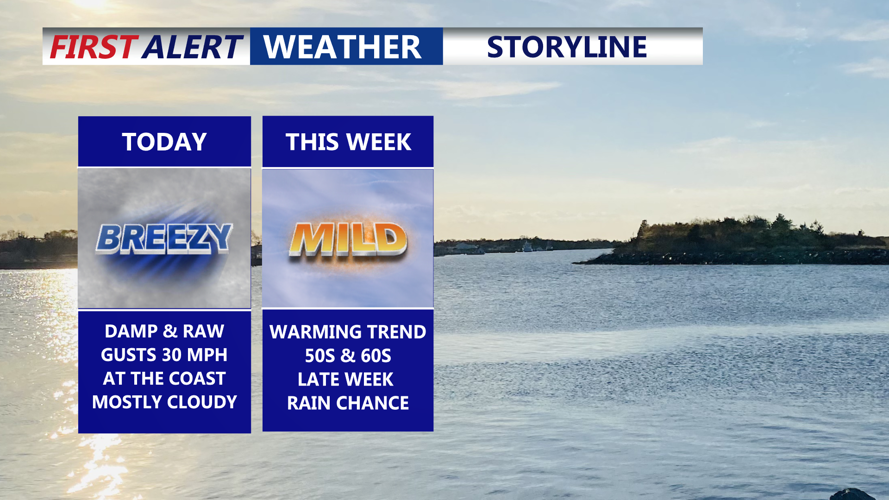
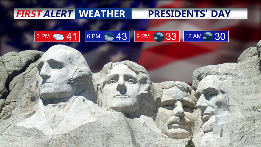
DELMARVA -- Kicking off the week with a raw, late-winter feel across the peninsula. Expect mostly cloudy skies for your Presidents Day and a persistent northeast onshore flow, keeping temperatures held down to the upper 30s to low 40s.
Mostly cloudy skies, temperatures in the low 40s, winds out of the northeast gusting 30-35 mph.
The wind will be a headline, especially near the beaches and along the bays, where gusts of 30 to 35 mph could make it feel colder and create choppy conditions on the water.
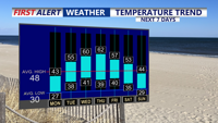
A nice warm up is underway this week, temperatures rising into the 50s and 60s.
Tonight stays partly to mostly cloudy, and with the breeze easing some inland, temperatures dip to the upper 20s to low 30s.
A notable shift arrives Tuesday as the warming trend begins. High pressure sliding offshore flips our winds around to the southwest, tapping milder air. Look for a mix of sun and clouds with highs jumping into the mid 50s—a big change from Monday.
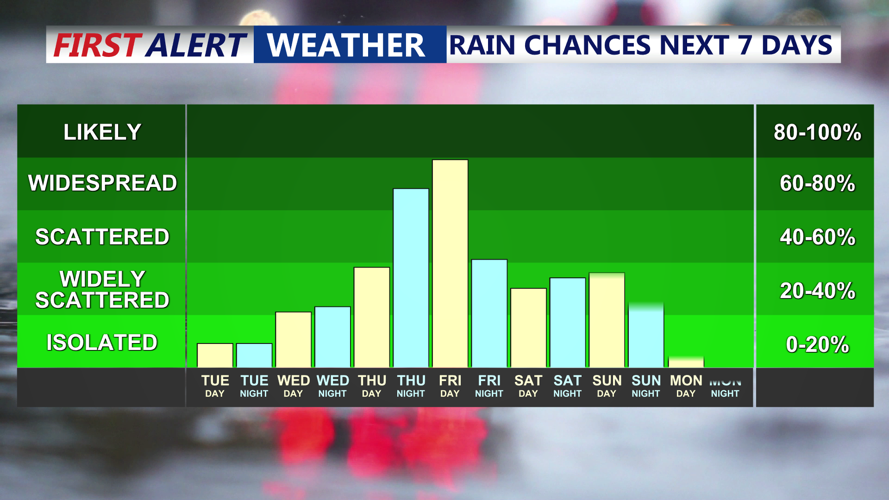
That mild pattern strengthens Wednesday as a warm front lifts through the region. Skies trend partly sunny, and highs climb into the upper 50s to low 60s. While most of the day looks dry, an isolated shower late in the day can’t be ruled out.
Warm air remains in place Thursday with partly cloudy skies and highs again in the low 60s. By Friday, an area of low pressure moves in, bringing periods of rain to the peninsula.
The pattern stays unsettled into the end of the week. Another system is expected Friday into Saturday, and at this time it appears to be mainly an all-rain event as well.
Temperatures start to trend cooler by the weekend: highs near the low 50s Saturday, then falling to the lower to mid 40s by Sunday. There’s potential for yet another system late in the weekend, but confidence is low—guidance ranges from all rain to a scenario that could include measurable snow. It’s too early to pin down precipitation type or impacts, but it’s a forecast we’ll be watching closely as the week goes on.
Chris Mastrobuono is a South Philly native, but has come to join
the CoastTV meteorology team. With over three years of experience
delivering accurate, passionate and insightful weather analysis, he
is eager to report on the coast. Previously, he spent over two
years as a morning meteorologist at WEVV CBS/FOX in Evansville,
Indiana.