



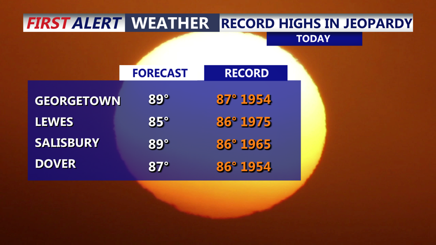
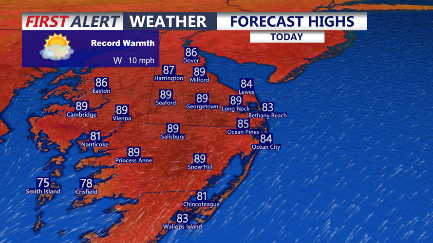
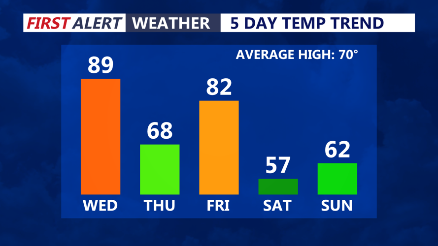

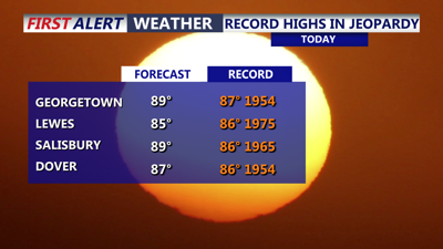
DELMARVA -- Record setting warmth on the peninsula today as we bask in sunny, warm, muggy conditions. Highs today mid to upper 80s with some areas inland hitting 90. At the beaches mid 80s. Record high for Georgetown is 87 set back in 1954, Salisbury record high temperatures is 86 set back in 1965. Winds out of the west southwest 5 to 15 mph.

Record warm settles in under mostly sunny skies, highs in the mid to upper 80s, near 90 some inland areas.
A cold front will approach the area this evening through the overnight bringing increasing clouds and a chance for a few showers, not expecting a lot of rain from the front. Temperatures will fall into the upper 50s to low 60s.

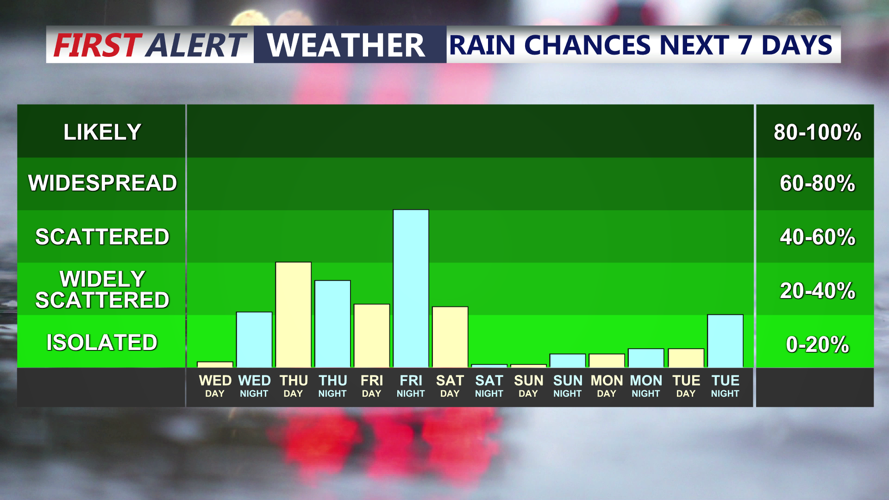
Few showers possible tonight and on Thursday, better chance of showers and a few thunderstorms comes Friday night as a strong cold front pushes through.
For Thursday, we turn much cooler under partly sunny skies. A few showers around in the morning, then another round possible later in the day and at night as a warm front lifts through. Temperatures Thursday in the 60s with east northeast winds gusting to 25-30 mph.

See-saw temperatures through the weekend, low 80s Friday to 50s for highs Saturday.
The temperature see-saw continues through Friday, turns warm and muggy again under partly sunny skies. A few morning showers are possible, highs in the low 80s. A stronger cold front approaches late in the day through the night. This front will bring the threat of a gusty thunderstorms and chance for showers. The Storm Prediction Center has the whole peninsula in a "Marginal" severe risk, primary threat is damaging winds. The winds will turn quite gusty behind the front.
Temperatures take a big plunge into Saturday, highs in the mid to upper 50s with lots of sunshine, but blustery, winds will gust out of the north to 40 mph. Some patchy frost is possible Sunday morning as temperatures fall into the upper 30s to low 40s. Sunday will feature beautiful fall sunshine with highs in the low 60s.
Staying dry through next week as a strong area of high pressure remains in control, temperatures rebound back into the upper 60s to low 70s through next week.
