


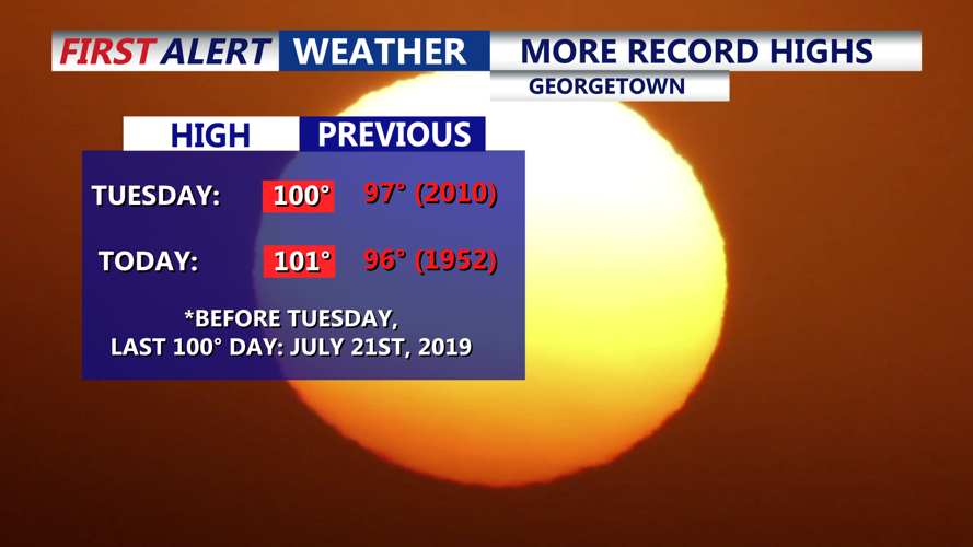


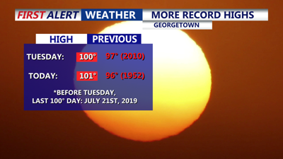
DELMARVA -- Wednesday marks another sweltering chapter in Delmarva’s heat wave, as Georgetown recorded a high of 101 degrees—eclipsing the previous June 25 record of 96 set in 1952. It was the second straight day Georgetown hit the century mark, with little relief overnight as lows linger in the mid to upper 70s under mainly clear and muggy skies. A stray shower or thunderstorm can’t be ruled out.

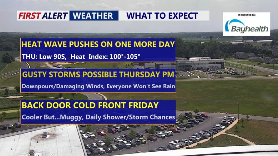
Another day of of triple digit heat indices Thursday with afternoon-evening storm chances.
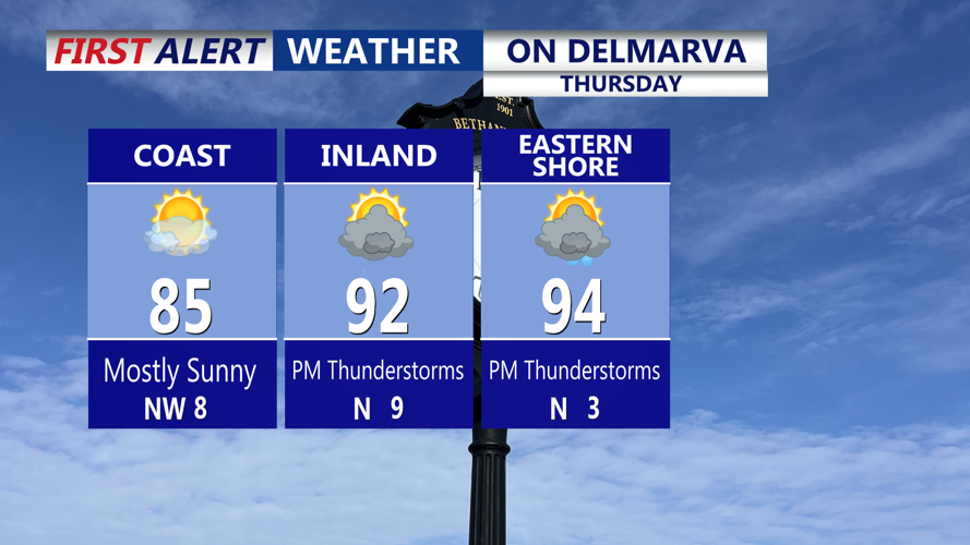
Thursday continues the streak of oppressive heat, with forecast highs ranging from the upper 80s to low 90s.

Hot and humid Thursday, PM showers and gusty storms possible.
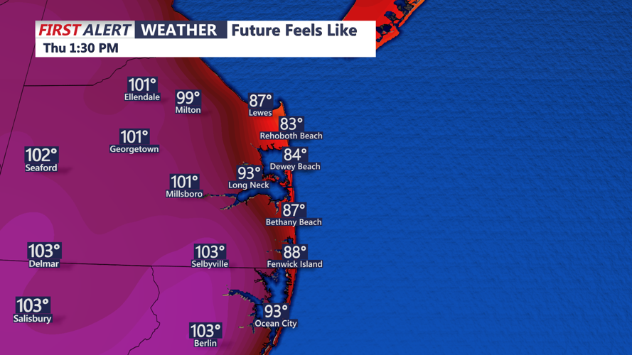
However, humidity will push heat index values into the dangerous 100 to 105 range.

Heat Indices Thursday between 100 to 105.
The Storm Prediction Center has placed all of Delmarva under a Marginal (Level 1 of 5) risk for severe weather Thursday afternoon and evening. While widespread severe storms are not expected, isolated cells could produce damaging winds— stay alert through the evening.
Change is on the horizon, as a backdoor cold front is expected to dip southwest across the region Thursday night. While the front should bring a slight reprieve in temperatures, the combination of warm, moist air overrunning the boundary could lead to more showers and thunderstorms overnight. The risk for severe weather decreases, but heavy rainfall is possible due to high atmospheric moisture content.

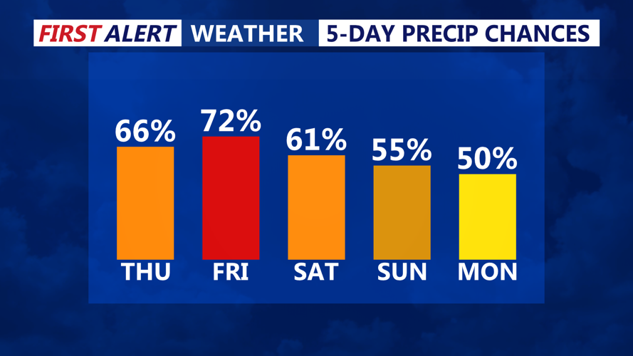
Daily shower and storms chances through next Tuesday.
Friday brings a noticeable shift in conditions. Highs will drop into the upper 70s to low 80s thanks to cloud cover and an easterly flow from high pressure settling near the Canadian Maritimes. Humidity will stick around with dew points in the 70s. However, westerly flow aloft and a weakening upper ridge could still trigger scattered showers and storms through the day and into Friday night.
By Saturday, the front will lift northward again, likely stalling over or near the region. As additional upper-level disturbances move through, another round of showers and thunderstorms is likely late Saturday into Saturday night. High temperatures will bounce back to near or above average. Highs over the weekend will range from the upper 80s to low 90s.
Looking ahead into early next week, unsettled weather remains in the forecast. Sunday and Monday bring continued storm chances as the stalled front meanders. A stronger cold front is expected to cross Delmarva on Tuesday, potentially bringing another bout of rain and thunderstorms before conditions begin to settle on Wednesday.