


DELMARVA - Expect to start Thursday mainly dry as a warm front lifts north and ushers in hotter, more humid air across southern Delaware.
The morning hours should feature increasing southwest winds and rising humidity. While showers or storms may affect areas farther north early Thursday, much of Delmarva is expected to remain dry through the morning and into the early afternoon.
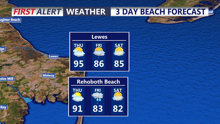
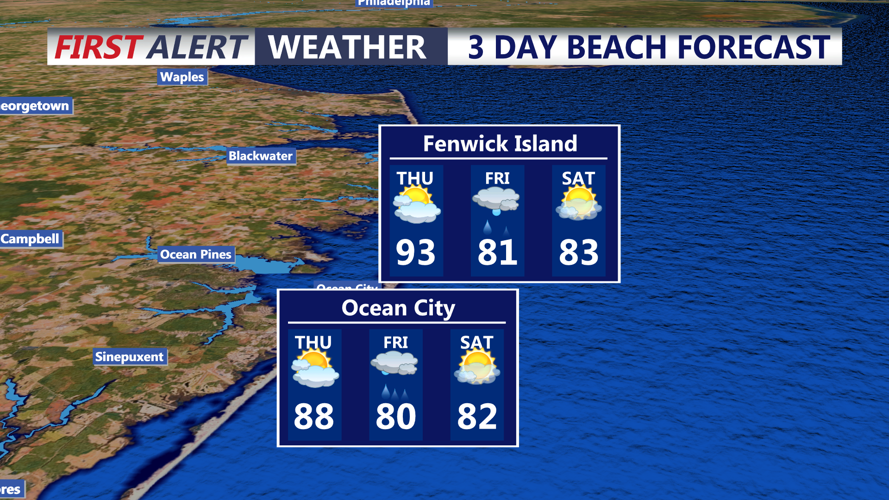
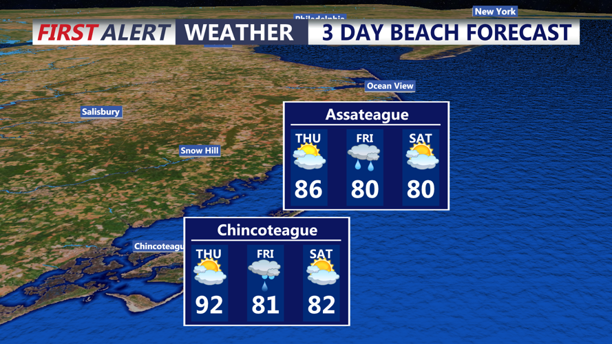
Temperatures are forecast to climb into the upper 80s to lower 90s by Thursday afternoon. With dew points rising into the upper 60s to near 70, heat index values could reach the low to mid-90s.
The main concern will come later Thursday as a cold front approaches the region. Isolated to scattered thunderstorms may develop Thursday afternoon and evening, and any storms that form could become severe.
Damaging wind gusts are the primary threat. Hail also is possible in stronger storms. Even outside thunderstorms, southwest winds of 15 to 25 mph are expected, with gusts commonly reaching 30 to 35 mph. Some gusts could approach 40 to 45 mph.
The storm threat should diminish late Thursday night into early Friday morning as the front moves through the area. Residents should stay alert for changing conditions, especially Thursday afternoon and evening, and have a way to receive weather warnings.
