


DELMARVA - On Friday, the remnants of Tropical Storm Debby will lift northward through central Pennsylvania, passing to our west while merging with a frontal boundary. This process will start to give Debby more extra-tropical characteristics, but it will still carry substantial moisture, with precipitable water values exceeding 2.5 inches.
While the very heaviest rainfall is expected to stay to our west, Delmarva will still experience widespread showers, heavy at times, with embedded thunderstorms on Debby’s eastern side throughout the day. The heaviest rain is likely to be north and west of the urban corridor, particularly in areas like Berks County and the southern Poconos. However, areas along and east of the I-95 corridor will also see heavy showers, and given the recent wet conditions, scattered instances of flash flooding are possible.
Additionally, there is growing concern about severe weather for Friday. Although Convective Available Potential Energy (CAPE) values won't be particularly high, there will be significant low-level shear (0-1 km shear of 30-40+ knots) and helicity, along with lowering Lifted Condensation Levels (LCLs). These factors create favorable conditions for tornado development, which is not uncommon in scenarios where a tropical system passes to the west.
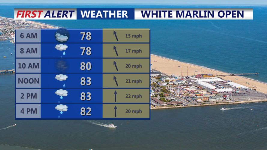
Forecast models indicate a squall line moving from west to east through the area late in the afternoon into the evening. This line could contain tornadic circulations, as could earlier cells and clusters moving from south to north ahead of the line. Apart from the severe weather threat, winds will be quite gusty on Friday, generally 15 to 25 mph out of the south, with gusts of 30 to 40 mph. This will bring a very muggy airmass to the region, with dew points well into the 70s despite high temperatures only reaching around 80 degrees.
Residents are advised to stay alert for weather updates and potential warnings, as conditions are expected to be dynamic and potentially hazardous.
