


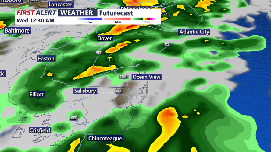


DELMARVA - Tuesday’s blue skies and near 70-degree warmth mark the last stretch of mild weather before changes arrive across Sussex County. A cold front moving in from the west will bring a round of showers late Tuesday night, followed by cooler and breezier conditions through Wednesday.
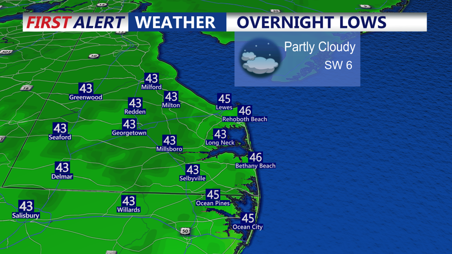
Forecasters say showers will begin to develop after 8 p.m. and become most widespread between 10 p.m. and 3 a.m. Rainfall totals are expected to remain light — generally around a tenth of an inch, though isolated areas could see up to a quarter-inch. Overnight lows will dip to near 50 degrees inland and into the mid-50s along the coast.
Conditions should improve after daybreak Wednesday, with clouds giving way to some sunshine before increasing again later in the day as an upper-level trough lingers overhead. While most of Sussex County should stay dry, a few stray sprinkles can’t be ruled out to the north.
Winds will pick up through Wednesday afternoon, gusting up to 30 mph, making it feel noticeably cooler. Highs will reach the 60s across most of the area before dipping into the 40s Wednesday night.
Cooler air will settle in for the end of the week, with highs in the upper 50s to low 60s Thursday and Friday. A weak cold front moving through Thursday night will reinforce that chill, and some spots could see frost by early Friday morning if winds ease.
By the weekend, high pressure is expected to build from the southwest, bringing drier and mostly sunny conditions across the county.