


DELMARVA - Sussex County residents can expect a noticeable shift in weather conditions starting late Wednesday night as a weakening high-pressure system gives way to approaching storm systems through the weekend.
A ridge of high pressure over the Ohio River Valley continues to dominate the weather pattern into Wednesday night, supporting fair skies under zonal upper-level flow. Conditions will remain mostly calm and dry through the night, with light southwest winds.
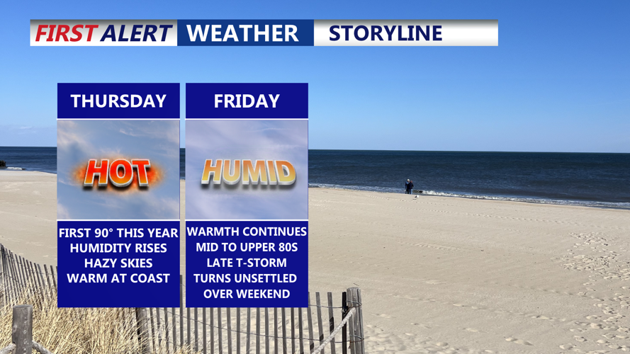
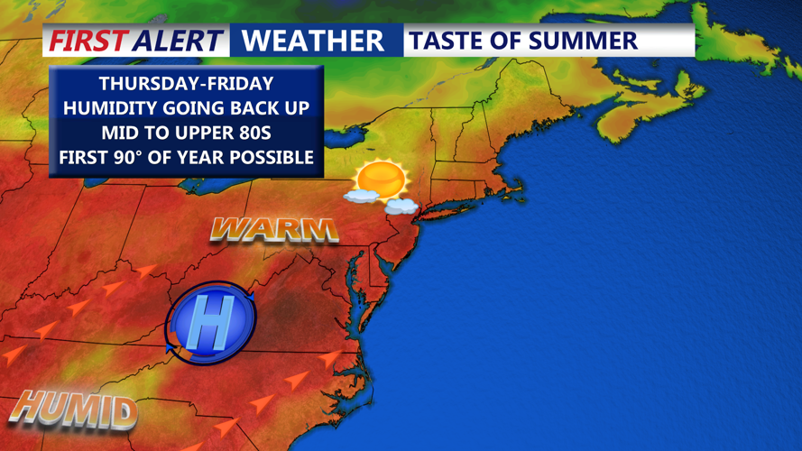
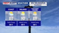
By Thursday, the high pressure begins to erode, and a cold front will push southeastward from the Great Lakes region. While most of Thursday remains dry and seasonable, clouds will gradually increase into the afternoon. Late Thursday into Thursday evening, the front may trigger isolated showers and thunderstorms, mainly north of the region. While Sussex County is not the primary target area, any storms that do drift southward could produce brief gusty winds and localized heavy downpours, given precipitable water (PW) values between 1.25 and 1.5 inches and mid-level winds of 40–50 knots.
Friday marks the beginning of a more unsettled stretch. High pressure moves offshore and a stationary front sets up over the Mid-Atlantic, with a low-pressure system slowly approaching from the west. This system will pass through Delmarva Friday night into Saturday.
Expect increasing cloud cover Friday with isolated to scattered showers possible in the afternoon. Thunderstorm chances will increase by evening, especially overnight, as shortwave energy interacts with the stalled front. While the potential for severe weather remains low, elevated dew points and instability over Delmarva may allow for a few rumbles of thunder and brief heavy rain.
Rainfall becomes more widespread Friday night into Saturday morning as the low moves through the area. Intermittent breaks in precipitation are likely during the day Saturday before additional showers redevelop later. PWAT values climbing over 2 inches for Delmarva raise the risk for locally heavy rain, and the Weather Prediction Center currently places the region under a Marginal Risk for excessive rainfall.
Looking ahead to the weekend, the persistent onshore flow and abundant moisture may extend the period of unsettled weather into Sunday and Monday. Temperatures during this period will stay on the cooler side, with highs in the low to mid-70s on Sunday and upper 60s to low 70s on Monday.