



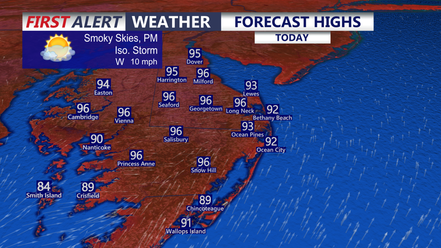
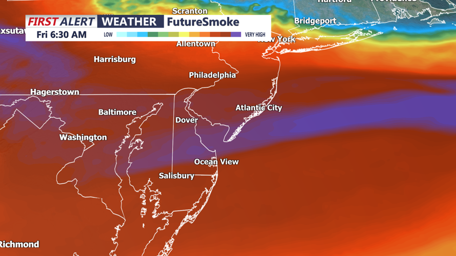

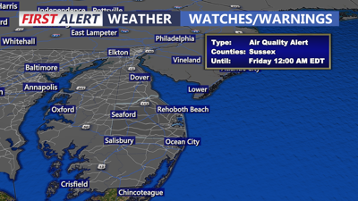
DELMARVA -- Canadian wildfire smoke will spread across Delmarva today, creating hazy skies, reducing visibility and potentially causing unhealthy air quality as temperatures climb into the 90s.

Smoky skies, isolated thunderstorms are possible with highs in the mid 90s, feeling like 101 to 105.
Heat index values are expected to reach 101 to 104 degrees across much of the peninsula. Thick smoke could filter some sunlight and prevent temperatures from reaching their full potential, but conditions will remain dangerously hot and humid.
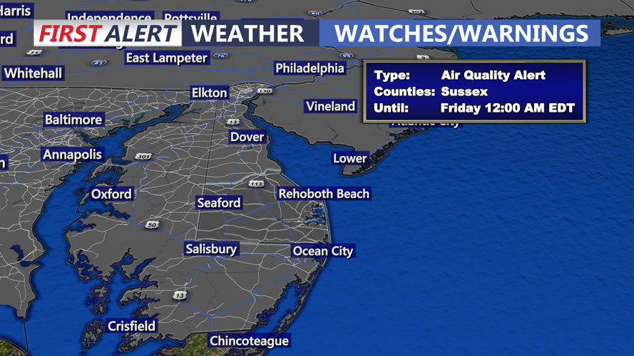
The smoke is expected to remain over the region through tonight and could linger into Friday. Some improvement is possible Friday, although the timing and extent of the clearing remain uncertain. Air Quality Alert up until midnight.

Plumes of Canadian wildfire smoke will continue to push into the region through Friday.
This episode is not expected to reach the severity of the widespread smoke event experienced in June 2023. However, residents may smell smoke at times, and air quality could become unhealthy for sensitive groups.
Exposure to smoke and ground-level ozone can cause headaches, fatigue, irritated eyes and sinuses, throat irritation, coughing and difficulty breathing. Children, older adults, people with asthma and those with compromised immune systems should limit strenuous outdoor activity and spend more time in air-conditioned indoor spaces when air quality deteriorates.
A stalled front could also trigger scattered showers and thunderstorms this afternoon and evening, mainly from Kent County northward. The amount of smoke may affect how unstable the atmosphere becomes, making the coverage of storms difficult to predict.
Northern Delmarva is under a marginal, Level 1 out of 5, risk for severe weather. Any storm that develops could produce frequent lightning, torrential rain and damaging downburst winds. Most communities farther south may remain dry.
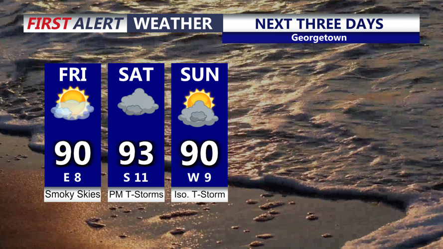
Friday should bring at least some improvement in the smoke, but clouds will begin increasing as another storm system approaches. Showers and thunderstorms could arrive as early as Friday night.

Smoky skies, lower humidity Friday, severe storms are possible Saturday.
Saturday is expected to be the most active day of the weekend. Multiple rounds of thunderstorms could cross Delmarva from the morning through Saturday night, with the greatest severe weather threat during the afternoon and evening.
Delmarva is under a slight, Level 2 out of 5, risk for severe storms Saturday. Damaging wind gusts will be the primary concern, although frequent lightning and localized severe weather will also be possible.
Atmospheric moisture will rise to unusually high levels, allowing storms to produce intense rainfall. Repeated thunderstorms over the same locations could lead to flash flooding, especially in urban areas, low-lying communities and places with poor drainage.
A cold front should move across the peninsula Saturday night into early Sunday. A few showers and thunderstorms could continue during the first part of Sunday before skies gradually clear from northwest to southeast later in the day.
High pressure should bring quieter weather to Delmarva Monday before another frontal system potentially returns with showers and thunderstorms Tuesday or Wednesday.
