


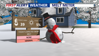


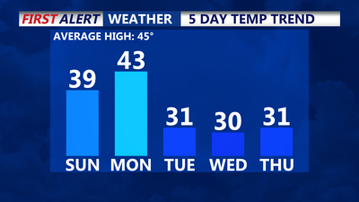
DELMARVA -- A pleasant end to the weekend with high pressure bringing sunshine and mild conditions today. Highs will reach the upper 30s to near 40 degrees, providing some relief for areas still blanketed by 6 to 12 inches of snow.

Melting is expected today and tomorrow with temperatures nearing 40 degrees.
Tonight will see calm weather under partly cloudy skies as lows dip into the teens and 20s. The high-pressure system currently over the Southeast will shift offshore on Monday, allowing a southwesterly flow to bring slightly warmer air into the region. Monday’s highs will return closer to seasonal averages, reaching the upper 30s to low 40s under a mix of sun and clouds.
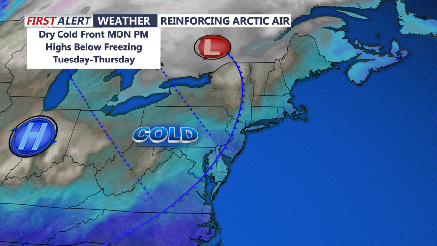
Monday night, a low-pressure system will track through southern Ontario and Quebec, bringing a dry arctic front into the Delmarva region by early Tuesday. While no precipitation is expected, the front will usher in colder air and breezy conditions. Lows Monday night will again drop to the teens and 20s.

Dry arctic front brings back below freezing highs midweek.
Tuesday will be noticeably colder, with highs struggling to reach the freezing mark. A modest pressure gradient will create breezy conditions, with wind gusts of 30 to 40 mph expected during the afternoon. Skies will feature more clouds than sun, adding to the chilly feel.
Canadian high pressure will dominate the region through midweek, ensuring dry but cold weather. Highs on Wednesday and Thursday will remain below average, accompanied by lighter winds. Temperatures are expected to return to near-normal on Friday as the high-pressure system shifts toward the Southeast coast.

Remaining dry and calm through next weekend.
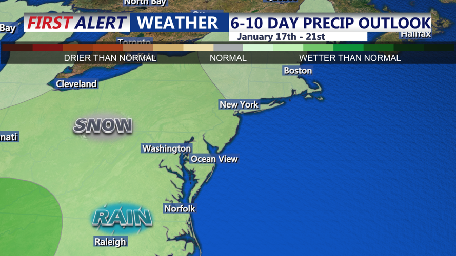
Next weekend could bring unsettled weather to Delmarva, with a low-pressure system potentially tracking to the region’s north. Depending on its timing and path, parts of the area may see rain or snow showers. Forecast models currently show uncertainty, and precipitation chances are capped at 50%.