



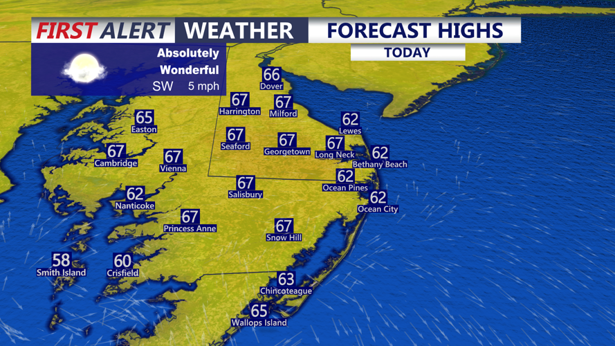

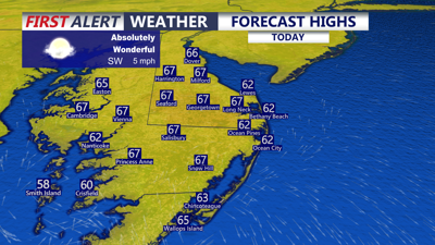
DELMARVA -- Our dry beautiful stretch of weather continues, today or tomorrow could easily be the picks of the week. Sunny mild highs in the mid to upper 60s. Winds out of the southwest 3 to 6 mph. Some higher clouds filter through the region into the evening. Tonight partly cloudy skies mid to upper 30s inland, low 40s at the beaches.

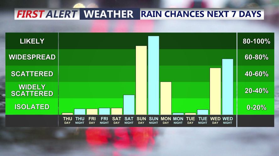
Two coastal systems may impact the peninsula over the next week, the first Sunday PM-Monday.
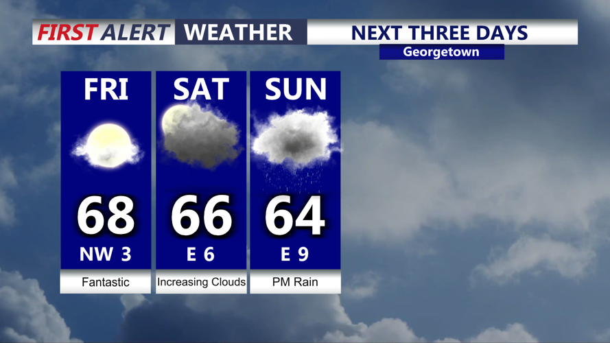
Friday will be another fantastic day with temperatures in the upper 60s to near 70 under mostly sunny skies. Temperatures will stay on the mild side into the weekend with highs generally in the 60s. Higher clouds will move in for Saturday but it remains dry.

Warm temperatures will continue into the weekend, clouds start to increase Saturday ahead of a coastal low Sunday-Monday.
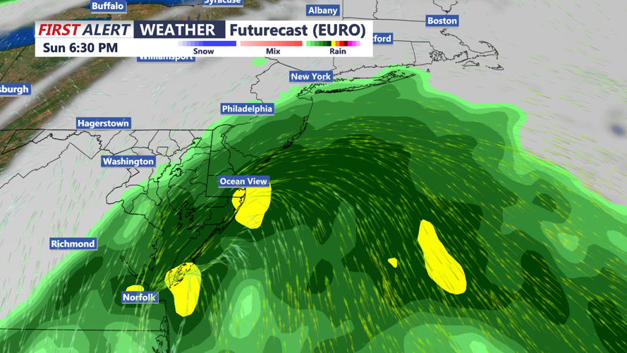
A coastal low will strengthen off the southeast coast and push north Saturday night into Sunday. The National Hurricane Center is also keeping their eyes on this system. There is a chance the storm could become subtropical or tropical storm, next name would be Kyle. Either way the impacts will be the same here on Delmarva regardless of the name. Still some uncertainty with the exact track that will determine where the heaviest axis of rain sets up. Heavy rain, gusty winds, coastal flooding and dangerous surf develops Sunday into Monday. One to two inches of rain is possible by Monday afternoon.

A coastal low will develop over the weekend and spread rain and wind into the region Sunday-Monday.
Behind the system it turns cooler and drier Tuesday and Wednesday with highs in the 40s and 50s. Ahead of yet another possible coastal storm as we head into Thanksgiving. Long range weather pattern does turn more active as we round out November and head into December.
