



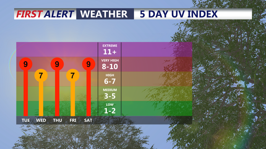

DELMARVA - Unsettled, hot and humid weather will continue from coastal Delaware south through Ocean City, Maryland, late Monday night through Tuesday night, with additional chances for showers and thunderstorms across the region.
Some showers or thunderstorms could linger into late Monday night following stronger daytime storms. Any remaining thunderstorms may produce locally heavy rainfall and gusty winds, although the overall severe weather threat should gradually diminish overnight.
Another round of showers and thunderstorms will be possible Tuesday as a cold front slows northwest of the Delmarva Peninsula. Forecast confidence in the timing and coverage of Tuesday’s storms remains limited, in part because Monday’s thunderstorms could influence how much instability is available the following day.
The risk of severe thunderstorms Tuesday appears lower than Monday, but a few storms could still become strong. Gusty winds and torrential downpours would be the primary concerns. The region also remains under a marginal risk for excessive rainfall, meaning isolated instances of flash flooding cannot be ruled out where heavier storms develop.
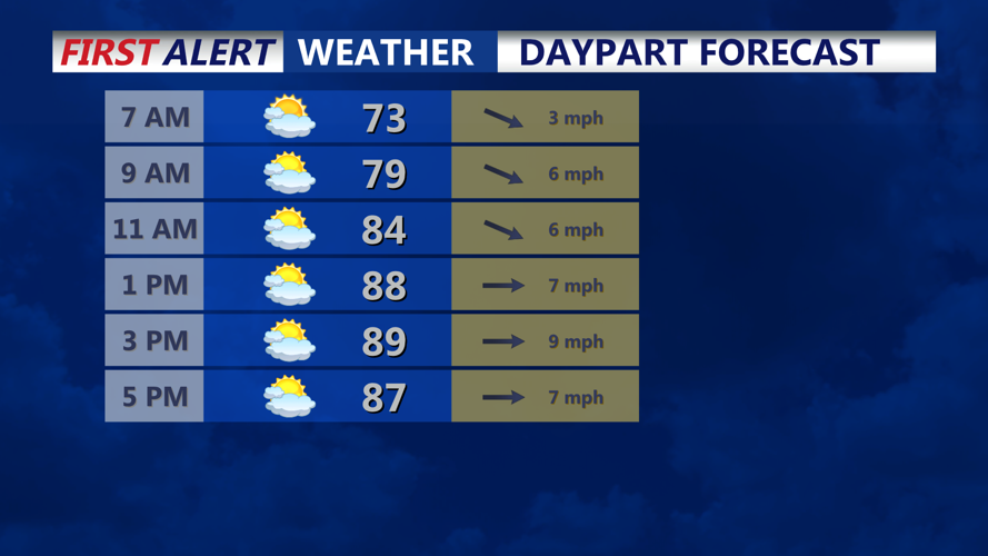
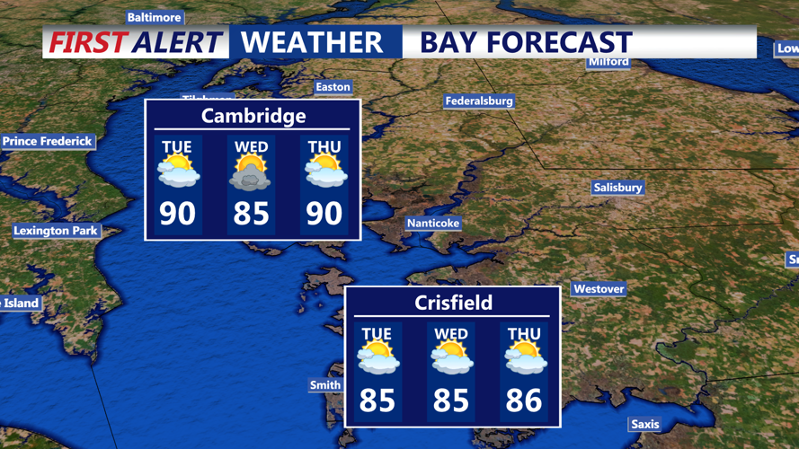
Temperatures Tuesday are expected to reach the mid-80s to lower 90s across much of the area. Humidity will remain noticeable, although it is expected to be somewhat less oppressive than during recent days. Heat index values should generally range from the mid-80s into the mid-90s.
Along the Atlantic coast, including Delaware beaches and the Ocean City area, increasing astronomical tides ahead of Wednesday’s new moon could also lead to spotty minor tidal flooding around the Tuesday evening high tide. Water levels will bear watching, particularly in low-lying roads, bayside communities and other flood-prone coastal locations.
Additional showers and thunderstorms could continue into Tuesday night as waves of energy move along the stalled frontal boundary. Periods of heavy rain and localized flooding will remain possible before more unsettled weather continues into midweek.
