


DELMARVA -- Another warm and humid evening Saturday as low clouds, patchy fog, and stratus clouds develop under a northeast to east flow. Overnight lows will settle in the mid-60s.

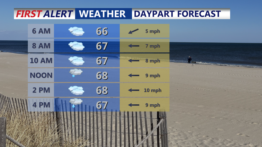
Mostly cloudy and muggy with late strong to severe storms possible, highs in the low 70s.
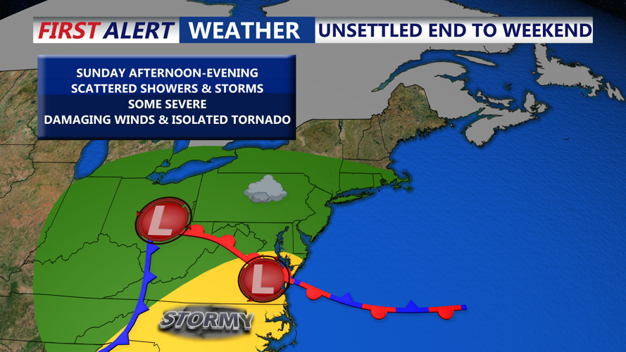
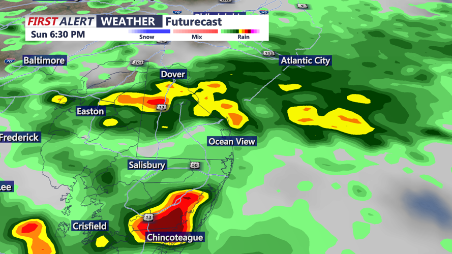
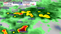
On Sunday, the region will sit north of a surface boundary and in an easterly flow pattern as high pressure builds to the north and an area of low pressure approaches from the west. While morning hours may bring a few showers, the bigger story develops later in the day. Between 3 p.m. and 10 p.m., strong to potentially severe storms are possible, especially across southwest Delmarva and the southern Eastern Shore.

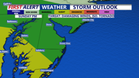
Severe storms possible Sunday afternoon-evening, greatest area of concern is SW Delmarva, Damaging winds & Isolated Tornado possible.
The Storm Prediction Center places the region under a “Marginal” to “Slight” risk for severe weather, with damaging wind gusts being the primary threat. However, an isolated tornado cannot be ruled out. Sunday’s highs will be held to the low 70s under mostly cloudy skies and humid conditions. Remain alert through the afternoon and evening for any watches or warnings.
As Sunday night progresses, showers and isolated storms taper off, especially after midnight. Lows will drop into the low 60s, with mostly cloudy skies continuing.
Monday will feature a temporary lull in activity. While dry conditions are expected for most of the day, a strong cold front associated with a low-pressure system over the Great Lakes will approach by nightfall. Temperatures will reach the mid to upper 70s to near 80 degrees, with increasing clouds and a continued muggy feel.
On Tuesday, another round of widespread showers and thunderstorms is likely as the cold front sweeps through the area. The bulk of the rain is expected during the morning and early afternoon hours. Afternoon highs will climb into the 70s, and muggy conditions will persist until the front fully passes Tuesday night.
After the front moves offshore Tuesday night, conditions quickly turn more summer-like. A ridge of high pressure builds in from the southwest, bringing clear skies and warmer temperatures.
From Wednesday through Friday, Delmarva will enjoy mostly sunny skies with a noticeable rise in temperatures. Highs will range from the low to mid-80s, with some inland and urban spots pushing toward 90 degrees by Thursday and Friday. The National Blend of Models gives a 20-40% chance of hitting 90 in places like Dover and Salisbury.
This stretch of dry, warm weather offers a welcome break from the recent unsettled pattern, however another front and chance for showers as the next weekend approaches.