


DELMARVA -- Showers and thunderstorms will end across Delmarva this evening as the severe weather threat comes to a close. Skies will clear quickly behind the departing cold front, but winds will pick up significantly. Gusts from the northwest could reach up to 35 mph overnight, with temperatures falling into the mid to upper 40s by Sunday morning.

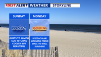
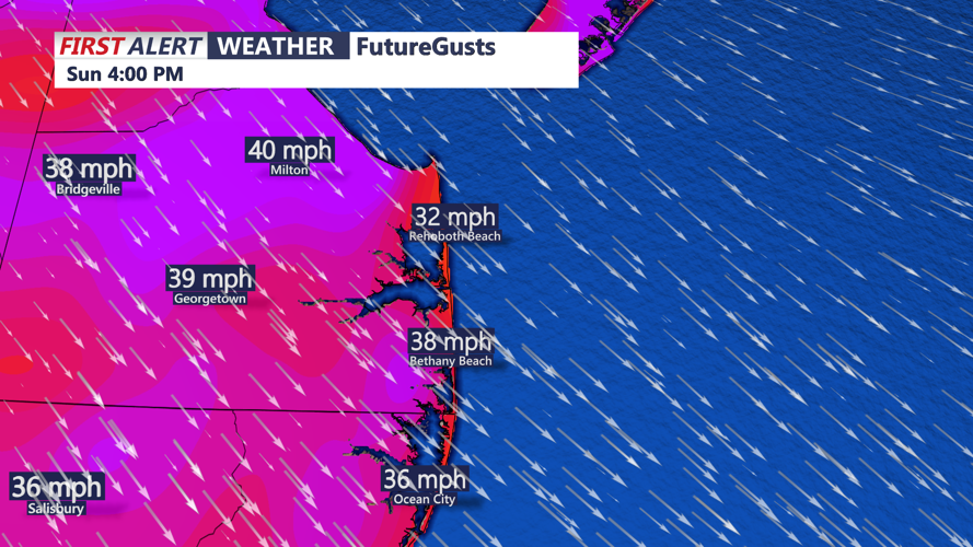
Beautiful start to Sunday, it will be windy with gusts 30-40MPH.
Bright blue skies will return to the region Sunday, but cooler temperatures and breezy conditions will persist. Highs are expected to reach between 64 and 70 degrees, with northwest winds continuing to gust up to 35 mph throughout the day.

Gusts 35 to 40 MPH out of the northwest Sunday afternoon.
Tree pollen levels — particularly from maple, ash, birch, and oak trees — will remain high, so allergy sufferers should continue to take precautions.

Tree pollen will continue to remain high Sunday.
Monday will bring a significant improvement in conditions. High pressure slides over the region, bringing wall-to-wall sunshine and much lighter winds. Highs will warm into the low 70s, about 10 degrees higher than Sunday’s readings. Winds will relax enough by the afternoon for a sea or bay breeze to develop near coastal areas. Overnight lows will dip back into the mid to upper 40s to low 50s under mostly clear skies.
The warming trend continues into Tuesday, with temperatures climbing to the low 80s ahead of the next weather system. A warm front lifting through the area may bring a few scattered showers later Tuesday. A cold front will follow on Wednesday, likely moving through early with limited moisture, so many areas could remain mostly dry. Temperatures will cool slightly Wednesday, and drier air will sweep back into the region.
Surface high pressure is forecast to slide by to the north on Thursday, briefly stabilizing the weather before another cold front approaches by Friday. Some showers could develop late Thursday into Thursday night ahead of the system. The risk for thunderstorms remains uncertain at this time but is not ruled out for Friday as a deeper trough brings more lift and instability to the region. Highs Thursday will be in the 60s to low 70s, with temperatures Friday dependent on how far north the warm sector reaches ahead of the front.