


DELMARVA - Sussex County residents can expect a wet and stormy start to the period late Thursday evening, followed by a gradual shift toward drier and milder conditions through Saturday evening.
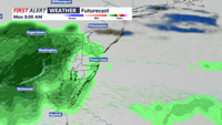
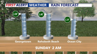
Showers and thunderstorms will continue Thursday night as a cold front pushes across Delaware. Rainfall totals may reach 1 to 2 inches, with locally higher amounts possible. While widespread severe weather is not expected, the Storm Prediction Center maintains a marginal risk for damaging wind gusts and an isolated tornado due to a low-CAPE but moderate-shear environment. Showers should diminish overnight as the cold front clears the area by Friday morning.
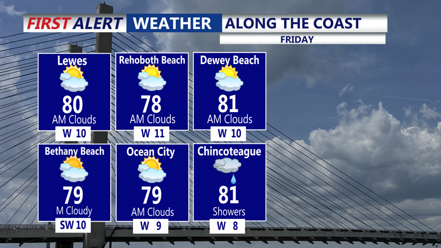
High pressure will build from the west on Friday, bringing drier and more stable conditions. While a few lingering showers are possible near the coast early in the day, most of Sussex County should see improving weather with seasonably warm highs in the lower 80s and lows Friday night in the mid-50s to lower 60s.
By Saturday, a weak surface trough just offshore may trigger a few light, scattered showers, but forecasters are not anticipating heavy rain. High temperatures will hover in the mid-70s with lows in the upper 50s to mid-60s Saturday night, signaling a comfortable and mostly dry weekend across the region.