



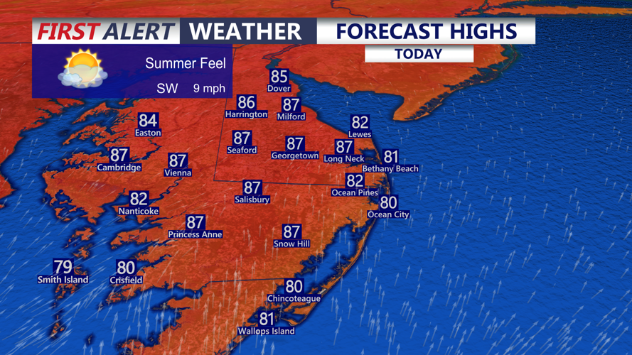
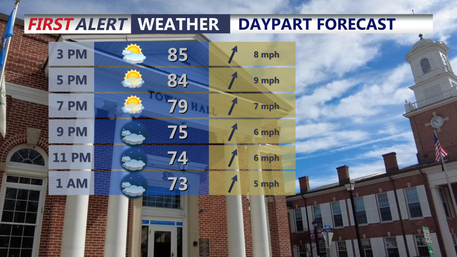

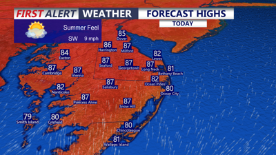
DELMARVA -- Summer-like feel has returned across the area, southerly winds will warm the region into the mid to upper 80s today. Humidity increasing as well with dew points back into the upper 60s.

Expect partly cloudy skies with highs in the mid to upper 80s, a stray shower is possible late this evening.
A weak cold front pushes through tonight bring not much in the way of rain. A stray shower possible. Otherwise we are looking at partly to mostly cloudy skies, muggy night falling into the upper 60s to low 70s.

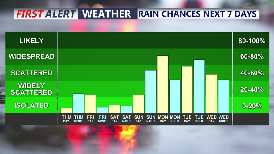
Isolated shower possible tonight, better chance for rain that could be steady into early next week.
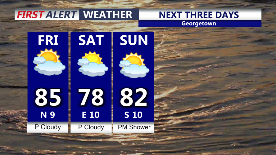
Behind the front temperatures don't fall off much Friday, a few morning clouds will give way to partly cloudy skies and highs in the low to mid 80s. Northerly winds develop pulling drier air in an humidity will drop into Saturday.

Few morning clouds Friday morning, pleasant afternoon and turning cooler Saturday.
The weekend will start off dry and cooler with highs in the upper 70s to low 80s, will have a northeast flow on Saturday under partly sunny skies. Sunday a warm front will lift through brining higher humidity and temperatures in the low 80s, a late shower is possible Sunday night as an unsettled weather pattern will develop into next week.
Chance for showers increases late Sunday, will have mostly cloudy skies Sunday with highs in the low 80s, humidity rises once again as a warm front lifts through the area.
An area of low pressure and cold front will push through Monday, that front potentially stalling over the region through Wednesday. Also developing onshore flow will keep the region dreary and damp through midweek. Expect periods of on and off rain beginning Monday, steadier rain is possible. With the rain and clouds temperatures will be in the 60s and 70s for most of next week. Fall officially arrives Tuesday at 8:05 PM.
