


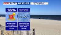


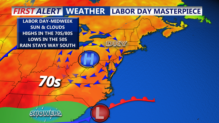


DELMARVA -- A picture-perfect Labor Day Weekend continues Sunday across Delmarva, thanks to a ridge of high pressure extending from the Great Lakes into the Northeast.

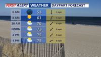
Chilly start to our Sunday will give way to a sensational day with highs in the mid to upper 70s.
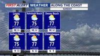
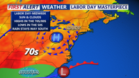
Sunday will feature mostly sunny skies, with highs reaching the mid to upper 70s and a low rip current risk at the coast. Winds will turn out of the northeast at 5 to 10 mph, keeping conditions comfortable for outdoor activities. By Sunday night, clear skies will allow temperatures to cool into the mid to upper 50s, providing a crisp and refreshing end to the day.

Sunshine and a wonderful final day of August on Delmarva, LOW rip current risk.
Labor Day itself will bring more sunshine and highs in the upper 70s, with temperatures pushing near 80 by Tuesday. High pressure will remain the dominant feature through midweek, maintaining tranquil conditions and temperatures slightly below average for early September.

Below average temperatures, high pressure keep us sunny and dry through the holiday weekend.
By Wednesday and Thursday, an area of low pressure is expected to develop off the Southeast coast while a cold front advances from the Great Lakes. The combination will increase rain chances, with showers likely from early Thursday into Thursday night. Depending on the system’s timing, showers could linger into Friday.
Once the front passes, another area of high pressure will build in, returning cooler, dry, and comfortable conditions for next weekend across Delmarva.
