



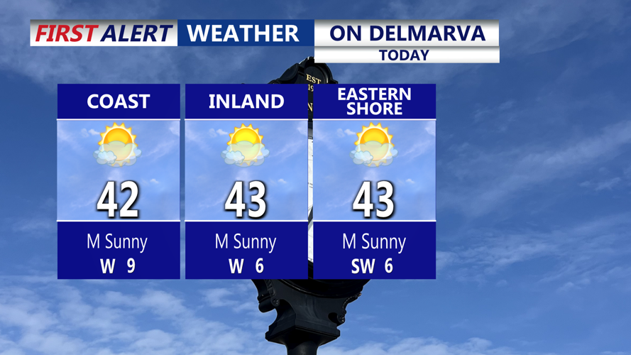

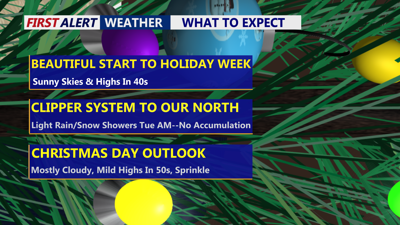
DELMARVA -- High pressure will dominate the weather pattern across Delmarva today, delivering sunny skies and seasonably cool temperatures. Afternoon highs are expected to reach the low 40s, with west to northwest winds at 5 to 10 mph this morning, shifting southwest around 10 mph by the afternoon.

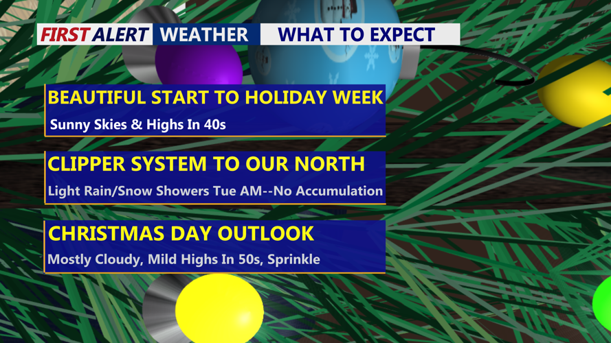
Mostly sunny skies and highs in the low 40s, clouds increase tonight.
Clouds will increase tonight as high pressure moves offshore.

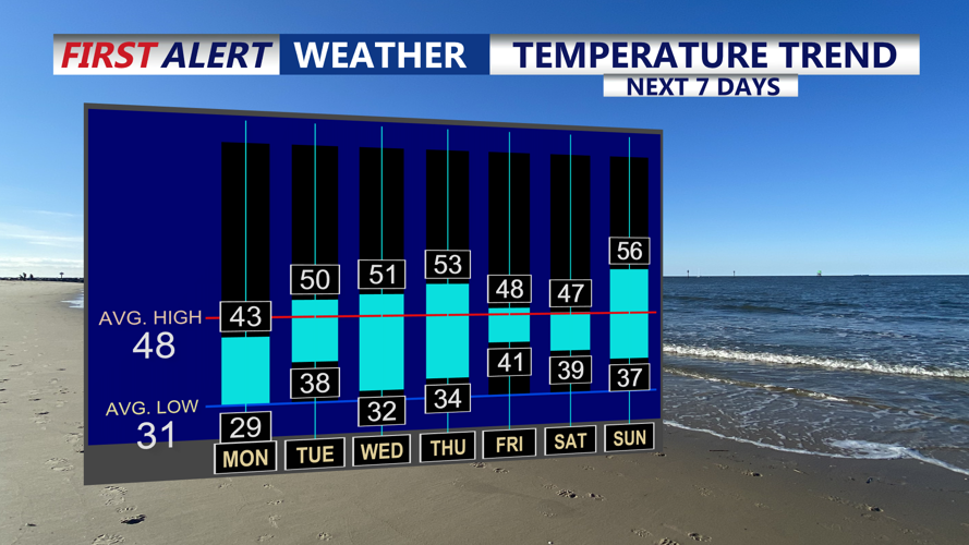
Slightly above average temperatures as we approach Christmas Day.
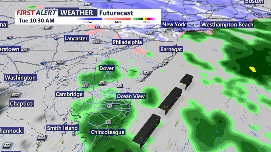
Overnight lows will fall into the upper 20s to low 30s ahead of a weak clipper system expected to move through the region early Tuesday. That system could bring scattered light snow or rain showers Tuesday morning, though no major impacts are anticipated and many areas may see little to no precipitation. The best chance for light snow appears north of Delmarva.

Weak clipper system passes through Tuesday morning bringing a few light showers.
Any lingering precipitation should taper off by late morning or around midday Tuesday. Temperatures will gradually rise through the afternoon, topping out in the upper 40s to near 50 degrees. Skies are expected to remain mostly cloudy through the day.
Lows Tuesday night into Wednesday morning will range from the mid to upper 30s. Weak high pressure will then build in from the Great Lakes, settling over Delmarva by Christmas Eve night into Christmas morning. Temperatures will stay close to normal for late December, with highs in the 40s to low 50s on Christmas Eve. It may be breezy at times, with northwest wind gusts near 30 mph possible during the day, becoming lighter overnight. Mostly sunny skies are expected Christmas Eve, with clouds increasing overnight.
Christmas Day is expected to be fairly quiet overall, though a weak clipper system could bring a brief chance of light rain or sprinkles during the morning. High temperatures will range from the upper 40s to low 50s, with mostly cloudy skies. Christmas night will remain cloudy, keeping lows milder in the mid 30s to low 40s.
Looking ahead to the end of the week, forecast confidence drops significantly. A stronger system could impact the region Friday, bringing a higher chance of precipitation. While rain is possible, recent model trends suggest colder air could introduce the potential for wintry precipitation. Conditions remain uncertain, and unsettled weather may linger into the weekend.
