


DELMARVA - A brief break from winter is expected in Sussex County as milder air settles in late Friday and carries through Saturday evening, pushing temperatures up and helping speed along snowmelt before colder air returns later in the weekend.
From late Friday into Friday night, the forecast favors generally quiet weather as the warming trend gets underway. Any remaining snow and ice in shaded areas should continue to diminish, though runoff may increase where melting is ongoing.
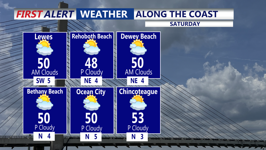
Saturday looks like the warm spot in the short-term forecast, with highs expected to climb well into the 50s across Sussex County — a springlike feel for late winter. The mild air should make for a favorable day for travel and outdoor plans, while continuing to chip away at leftover snow piles.
By Saturday evening, conditions should remain mild, but the next change is expected to begin lining up just beyond that window. A cold front is forecast to move toward the region Saturday night and could stall as it pushes through, setting up a sharper temperature drop into Sunday.
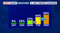
While the best chance for any snow appears to favor areas north of Sussex County — including the Poconos and far northern New Jersey — forecasters say the broader region could see spotty showers early Sunday as a low-pressure system tracks by to the north. For Sussex County, that would more likely fall as rain or a rain-snow mix at times, with limited or no accumulation expected locally given the warmer starting point.
Behind the front, colder-than-normal air is expected to return. Forecast guidance suggests Sunday highs across the southern Delmarva — including Sussex County — may run about 5 degrees below normal, a smaller dip than locations farther north, but enough to end the weekend warm-up.
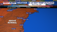
We are monitoring additional waves of low pressure through the middle of next week that could bring periods of wintry precipitation to the broader region, followed by a notable warm-up later next week with highs trending back into the 50s and 60s.
