


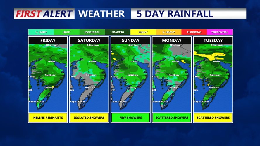


DELMARVA - A cold front will move southward into the Delmarva region, bringing with it some scattered showers and thunderstorms, especially in the evening hours. The front is expected to stall overnight, leading to a warm and humid night across the area. Lows will generally range from the mid to upper 60s, with some areas in southern Delmarva potentially dipping into the lower 60s.
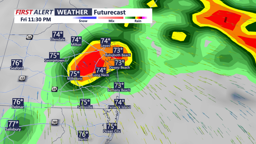
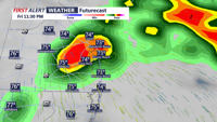
Friday: On Friday, moisture associated with Tropical Cyclone Helene, which will be absorbed into an expansive upper-level low over the southeastern United States, is expected to impact the Delmarva Peninsula. The stalled boundary from the previous night will serve as a focal point for precipitation, with the highest chance of rain occurring during the afternoon and evening. Expect widespread cloudiness with occasional showers, particularly in southern Delmarva where rainfall could accumulate up to half an inch. Despite the rain, temperatures will remain mild, with highs reaching the mid to upper 70s.
Friday Night: Showers will continue into Friday night, although they may become more scattered as the night progresses. The stalled front will still influence the weather, keeping conditions cloudy and damp. Overnight lows will range from the upper 60s in the south to around 60 degrees in the north, maintaining the warm and humid conditions for this time of year.