



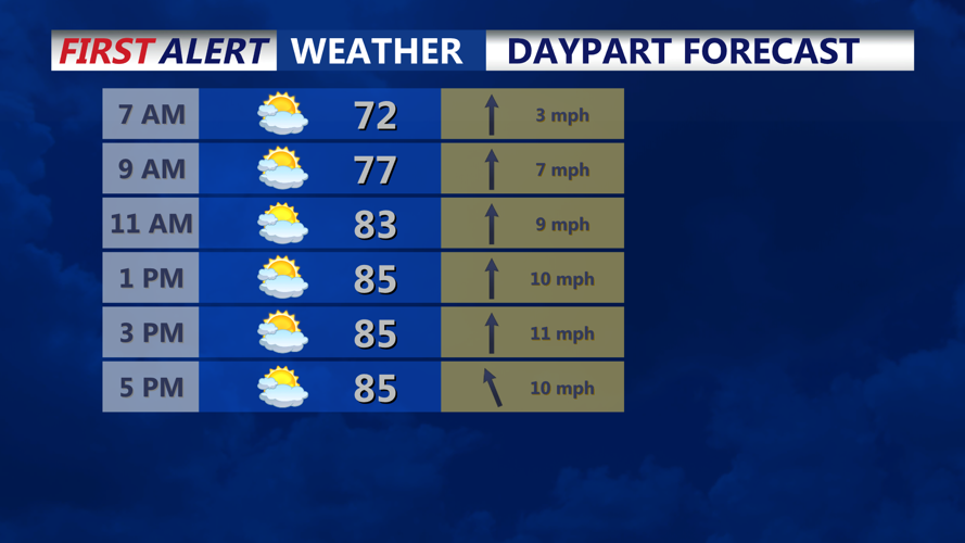

DELMARVA - Thursday will begin warm and increasingly humid as a warm front moves through the region and draws deeper moisture into Delmarva.
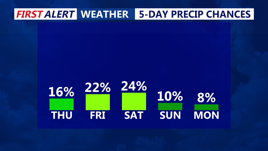
Isolated showers and thunderstorms are possible through afternoon, with some storms capable of producing heavy downpours, frequent lightning and gusty winds. Rainfall rates could become intense in stronger cells, raising the risk of localized flooding in poor-drainage areas. The best chance to see any severe storms today will be along the Mid-Shore and northern portions of the peninsula.
The atmosphere is expected to become increasingly unstable Thursday afternoon, creating the potential for a few strong to severe thunderstorms. Damaging wind gusts will be the primary concern, although an isolated tornado cannot be completely ruled out. The greatest severe weather threat is expected farther north and west, but Sussex County could still see locally strong storms.
Storms may continue into Thursday evening before becoming more scattered overnight. Conditions will remain muggy, with overnight temperatures staying mild under mostly cloudy skies.
By early Friday, attention will turn to an approaching cold front. Additional showers or thunderstorms will remain possible ahead of the front, with the exact timing of the boundary determining how much storm activity develops later Friday.
Drier and more comfortable conditions are expected to follow for much of the weekend once the front clears the region.
