



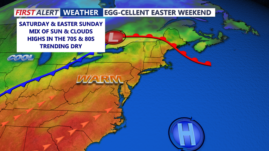
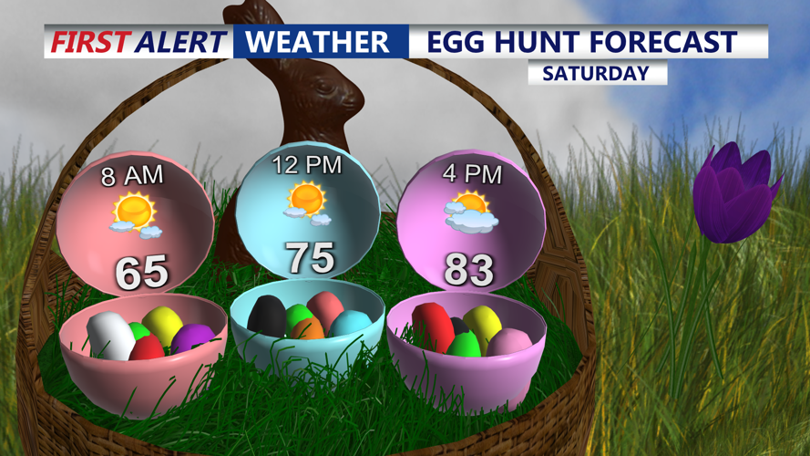
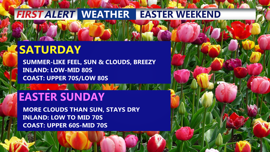


DELMARVA -- Clouds will thicken overnight Friday, trapping warmth and keeping overnight lows in the upper 50s to low 60s—much milder than recent nights. In fact I think most of the peninsula doesn't drop below 60. The southerly flow behind the warm front will help propel temperatures into the low to mid 80s on Saturday, offering ideal conditions for outdoor Easter egg hunts despite increasing cloud cover.

Looking good for any Easter egg hunts taking place on Delmarva Saturday.
A tight pressure gradient will bring a noticeable southwesterly breeze Saturday, with gusts reaching between 20 to 30 MPH. A cold front is expected to approach late in the day and pass through Delmarva overnight, shifting winds to the northwest and ushering in cooler air.
By Easter Sunday morning, temperatures will start in the 50s and 60s, with daytime highs climbing into the lower 70s inland and holding in the 60s along the coast. Despite the cooldown, conditions remain favorable for Easter festivities, albeit around 10 to 15 degrees cooler than Saturday.
High pressure will briefly settle over the region on Monday, bringing a mix of sun and clouds with seasonable temperatures. However, another cold front is poised to move through Delmarva Monday night, potentially delivering scattered rain showers and the chance for a thunderstorm.
While some showers may linger into Tuesday, the midweek outlook from Tuesday through Thursday turns dry and pleasant, with high pressure taking hold. Expect lows in the 40s and 50s and highs in the 70s, accompanied by minimal chances for rain.
Looking ahead to Friday and beyond, a shift in the upper-level pattern could increase the likelihood of showers and thunderstorms to close out the week.
