DELMARVA - High pressure will hold over the region through Tuesday, bringing mild and warm conditions across Sussex County before unsettled weather moves in midweek.
Ridging along the East Coast Monday afternoon will shift offshore overnight, allowing light southerly winds to draw in higher moisture. This setup will lead to areas of low clouds developing overnight into Tuesday morning. Temperatures will remain seasonably mild overnight, with lows in the low to mid-60s.
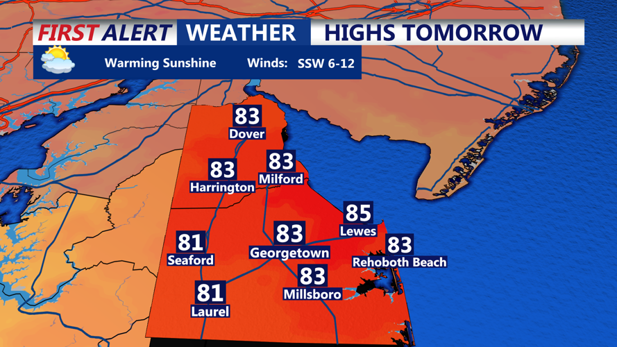
A warm front lifting through the region Tuesday morning will usher in warmer air, with highs reaching the 80s inland and 70s along the shore. However, an approaching cold front and an upper-level disturbance will bring a chance of showers and isolated thunderstorms late Tuesday, mainly to areas northwest of the I-95 corridor.
Showers and thunderstorms will persist Tuesday evening before tapering off after midnight. While some storms could briefly become strong over western areas, the overall severe threat remains low. Temperatures will stay mild overnight in the 60s.
The cold front is expected to cross Sussex County on Wednesday into Wednesday night, bringing another round of showers and possible thunderstorms. Highs will remain in the upper 70s to low 80s despite mostly cloudy skies.
By Thursday, the front may stall south of the area before lifting north again as a warm front. Another cold front is expected to arrive Thursday night into Friday, increasing the chance for widespread rain, some of which could be heavy at times. More seasonable temperatures will return Thursday as unsettled conditions persist.
Broad high pressure is forecast to build from the west Sunday into early next week, though forecasters say uncertainty remains about how tropical development in the western Atlantic could influence local weather conditions.


