


DELMARVA - A warm front lifting north through the region may bring scattered showers and thunderstorms to Sussex County late Tuesday night into Wednesday evening.
A stationary front south of the area is expected to move north as low pressure tracks through the Great Lakes on Wednesday. As the front approaches, some showers and thunderstorms may develop overnight across parts of Delmarva, including Sussex County.
The overnight storms should have limited instability, but stronger storms could still produce damaging wind gusts. The main concern would be isolated stronger thunderstorms capable of producing straight-line winds.
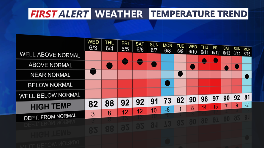
By Wednesday, southerly winds will bring warmer air and more moisture into the region. Temperatures in Sussex County are expected to rise into the upper 70s and lower 80s, with dew points climbing into the 50s and lower 60s.
Showers will become more likely during the day, with isolated thunderstorms possible across Delmarva. The best chance for more widespread thunderstorm activity is expected to remain farther north and west of the Philadelphia area, but Sussex County could still see scattered showers and a few storms through Wednesday evening.
Coastal areas should also watch for elevated tide levels. Spotty minor tidal flooding may continue along the Atlantic coast and Delaware Bay during evening high tides through Wednesday.
