


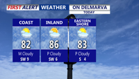


DELMARVA -- Another warm and humid day under a mix of sun and clouds, with high temperatures reaching the low to mid-80s. While most of the region will stay dry, an isolated shower or thunderstorm is possible late Wednesday into the evening.

A mix of sun and clouds, highs in the low to mid 80s, can't rule out a late isolated showers/storm.
Beachgoers should be cautious as a high rip current risk continues Wednesday with waves running 2 to 4 feet.
Overnight lows will be mild, dipping into the upper 60s to low 70s, with patchy fog possible early Thursday morning.
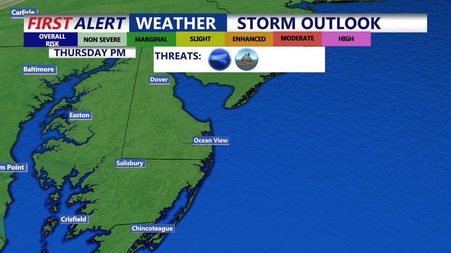
Thursday is a Yellow Alert Day as a cold front approaches the region, increasing the threat of severe weather. Highs ahead of the front will climb into the mid to upper 80s with winds out of the south-southwest gusting 20 to 30 mph. The Storm Prediction Center has the entire peninsula in a "Marginal" risk (1 of 5).

Storm Prediction Center has the entire Delmarva peninsula under a "Marginal" (1 of 5) risk for severe storms. Damaging winds is the primary threat with gusts to 60 MPH +
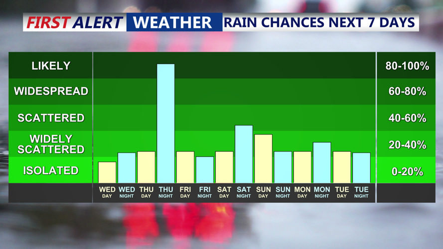
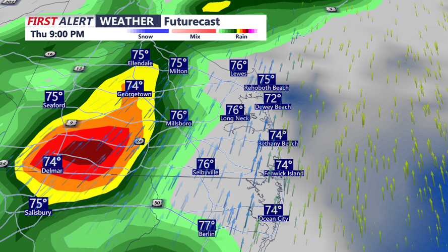
Most of Thursday will remain dry, but showers and storms are expected to develop over the Mid-Shore after 5 p.m., then push east across the peninsula through the evening. Isolated severe storms are possible, with damaging winds of 60 mph or higher as the primary threat.

A line of showers and storms pushes through late Thursday afternoon-evening, some storms could be severe with damaging wind gusts.
As the front stalls over the area Thursday night into early Friday morning, showers and downpours are likely, although the severe threat is expected to diminish. Friday will start damp but gradually clear through the day, with highs in the upper 70s to low 80s.
A weak surface low is expected to form along the stalled boundary just south and east of the Mid-Atlantic coast. This could allow a few showers to linger over the weekend, particularly Saturday and Sunday. Temperatures will remain at or above normal through the weekend.
The outlook beyond Sunday remains uncertain. Broad high pressure is expected to develop over the center of the country and slowly build east. Meanwhile, eyes are on the tropics as forecast models show a possible tropical cyclone forming over the western Atlantic early next week. How these systems interact will determine the weather pattern for Delmarva into early next week.
