



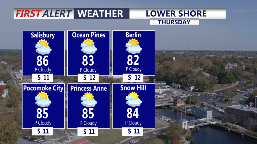

DELMARVA - Thursday morning will begin mainly dry across as high pressure continues moving offshore and a cold front approaches the region from the west.
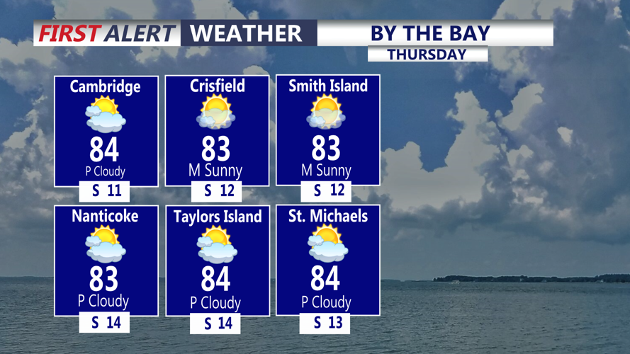
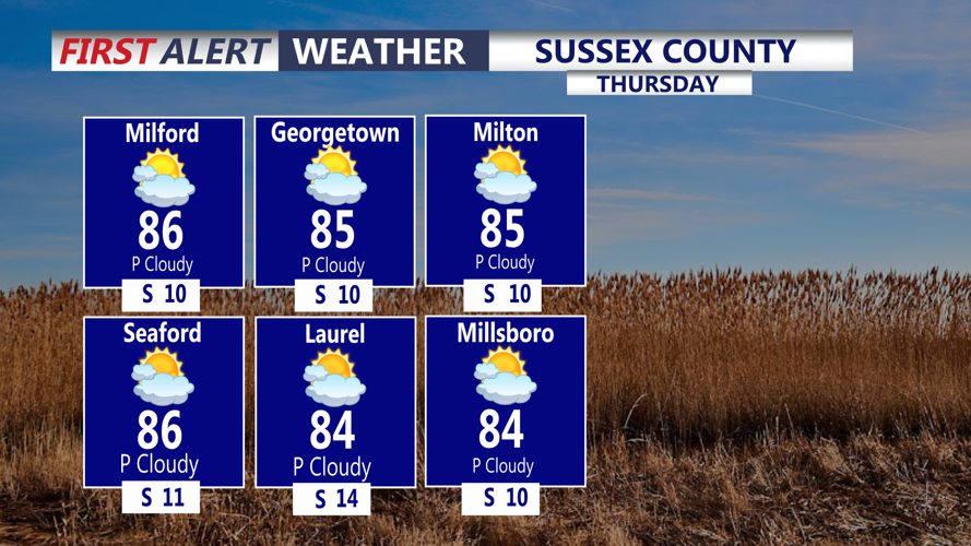
Southerly winds will draw warmer and more humid air in through the day. Temperatures will climb into the low to mid-80s Thursday afternoon, with dew points rising into the mid to upper 60s, making it feel noticeably more humid than earlier in the week.
Most of the daytime hours are expected to remain dry along the Route 1 corridor. South to southwest winds will generally remain around 6 to 17 mph. Along the Delaware beaches, seas are expected to remain around 2 to 3 feet with a low risk of dangerous rip currents.
The chance for rain will increase Thursday evening as the cold front moves toward southern Delmarva. Isolated to scattered showers and a few thunderstorms are possible Thursday night as the front crosses the region.
Some downpours could produce locally heavy rainfall because of increased atmospheric moisture, but widespread flooding is not expected. Severe thunderstorms are also not anticipated.
The cold front should move in by early Friday morning. Drier air will begin arriving behind the front, setting the stage for improving conditions Friday.
