


DELMARVA -- A series of storm systems is setting the stage for a soggy start to the week across Delmarva, with periods of rain, thunderstorms, and unseasonably mild conditions expected through Tuesday.

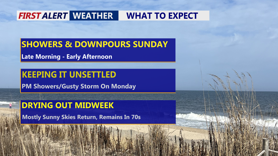
Cloudy skies, with late morning showers and downpours into the afternoon.
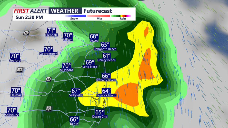
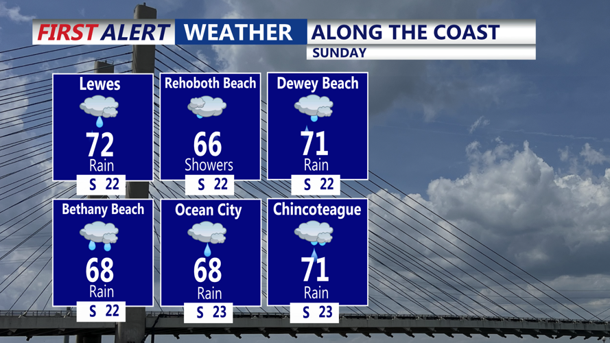
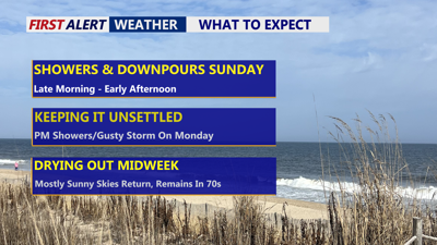
A cold front edging into the region Sunday will trigger widespread rain and possible downpours late Sunday morning into early afternoon.

Scattered downpours through Sunday afternoon on Delmarva.
Although skies remain cloudy throughout the day, conditions should begin to dry out by Sunday evening. Temperatures will remain mild, with highs reaching the low to mid 70s inland and upper 60s along the coast.

Expect a cloudy damp Sunday with scattered downpours.
Overnight, skies stay mostly cloudy with lows holding in the 60s. Spotty showers or even a stray thunderstorm can’t be ruled out, but much of the night should remain quiet.
The culprit behind the unsettled weather is a sprawling upper-level low, nearly stationary over the Ohio Valley. This system will continue sending spokes of atmospheric energy across the region through Tuesday, maintaining daily chances for rain. While Sunday’s rainfall is expected to be the most widespread, rounds of scattered showers and embedded thunderstorms are likely to redevelop Monday afternoon into Monday evening.
While instability appears limited due to southeasterly winds and cloud cover, a few gusty thunderstorms could still flare up, especially inland. Monday’s high temperatures will range from the mid to upper 70s inland, with lower 70s near the coast.
Tuesday brings a transition day as the upper low begins to weaken and drift northeast. Morning showers and isolated storms may linger, but clearing skies are expected during the afternoon. Highs will once again reach the mid to upper 70s.
By Wednesday, the atmosphere stabilizes as the weather pattern briefly turns quieter. Expect mostly sunny skies and highs in the mid 70s—likely the most pleasant day of the week.
However, this respite may be short-lived. Another upper-level trough will approach the region Thursday into Friday, bringing with it a new cold front and the chance for additional showers or thunderstorms. The timing of this front remains uncertain, which could impact how much instability develops.
Friday could usher in a notably cooler air mass, particularly if the trough amplifies across the Northeast and Mid-Atlantic. If that occurs, there’s potential for some instability-driven showers or even low-topped convection that may include small hail.
Looking ahead to the weekend, the upper-level system should lift out of the region by Saturday, with high pressure building nearby and moderating temperatures likely returning just in time for the mom's on Mother's Day.