


DELMARVA - A pair of low-pressure systems moving northeast from the Great Lakes and Tennessee Valley will keep Sussex County unsettled through Wednesday, bringing rounds of rain, fog and the chance for isolated thunderstorms before a cold front approaches.
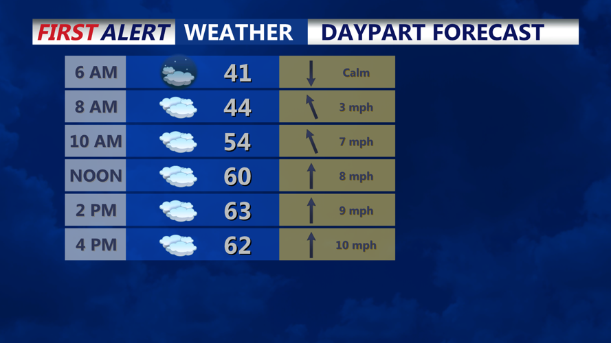
First wave of rain will taper off around midnight, leaving behind warm, muggy conditions overnight with fog and low stratus across the county.
A second round of showers moves in before dawn Wednesday as another weak low tracks through the region. Elevated instability may be enough to trigger a few rumbles of thunder across Delmarva, with ML MUCAPE values near 300 J/kg supporting that potential.
Low clouds and patchy fog are likely to persist into early Wednesday afternoon. Some breaks of sunshine may develop later in the day ahead of an approaching cold front, which could bring additional showers or a thunderstorm into western parts of the region by late afternoon or evening.
Overnight lows in southern Delmarva will hold in the upper fifties, while Wednesday’s highs climb into the mid to upper sixties. Rainfall totals from both rounds are expected to range from one-half to three-quarters of an inch.