


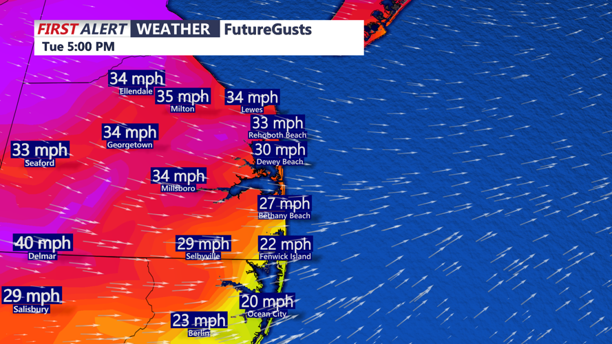


DELMARVA- A few scattered showers may linger early this afternoon, especially near the coast. Gusty northwest winds will develop this afternoon with gusts over 35 mph at times later today. Be sure to secure outdoor items. Highs will be in the low to mid 60s, with falling temperatures this evening.

A secondary cold front will sweep through late Tuesday night, though it will pass through dry. This front will usher in even cooler and drier air heading into midweek. Lows will be in the 40s by Wednesday morning. It will feel like the 3s0 with the wind.

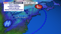
High pressure will settle in across the Eastern U.S., providing dry conditions and mostly sunny skies. Temperatures will remain seasonably cool on Wednesday with highs only in the 50s to around 60. Overnight lows on both Wednesday and Thursday will dip into the 30s, raising the potential for frost concerns. The better chance for frost occurs Thursday morning.

Daytime highs will gradually moderate into the upper 50s to low 60s by Thursday, climbing further into the 60s to near 70 by Friday.
Temperatures will rise well into the 70s on Saturday under mostly cloudy skies, likely the warmest day of the week. A front could trigger a few showers Saturday night. Conditions should improve for Easter Sunday, which currently looks dry with highs in the 60s.