



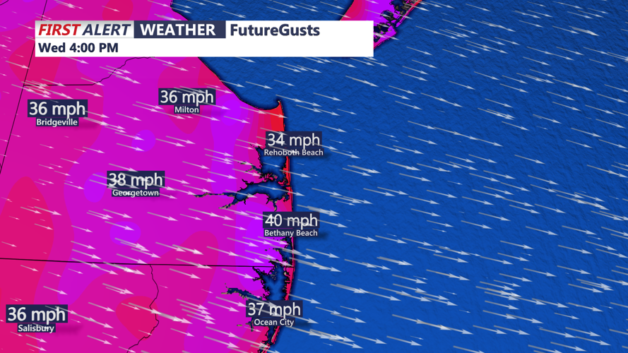

DELMARVA - After the departure of Monday night’s stormy front, the region enters a period of unseasonably cool and breezy conditions lasting through late Wednesday. The culprit: a broad upper-level low settling over the mid-Atlantic, ushering in gusty northwest winds and unstable air.
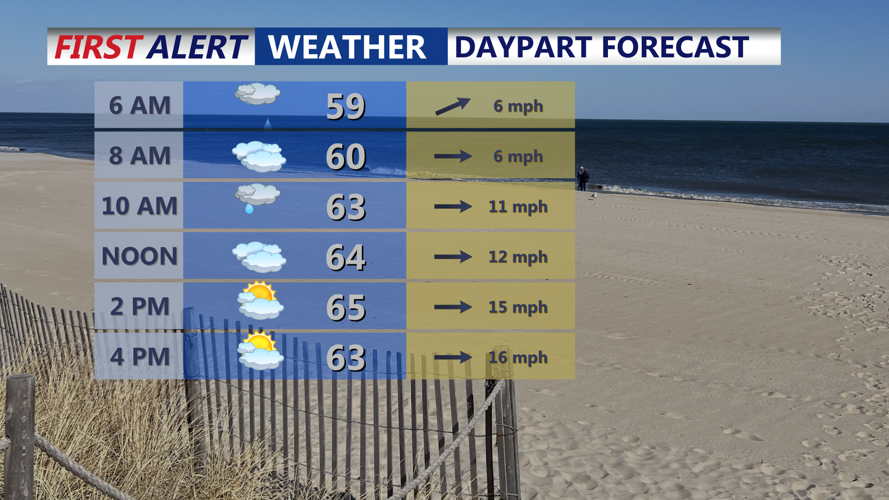
Tuesday begins with lingering moisture and energy from the departing front, sparking isolated coastal showers during the morning. By the afternoon, colder air aloft and steep lapse rates will foster additional pop-up showers across inland areas, particularly in the Poconos and northern Delmarva. Some of these could contain small hail or graupel, thanks to elevated instability and low freezing levels.
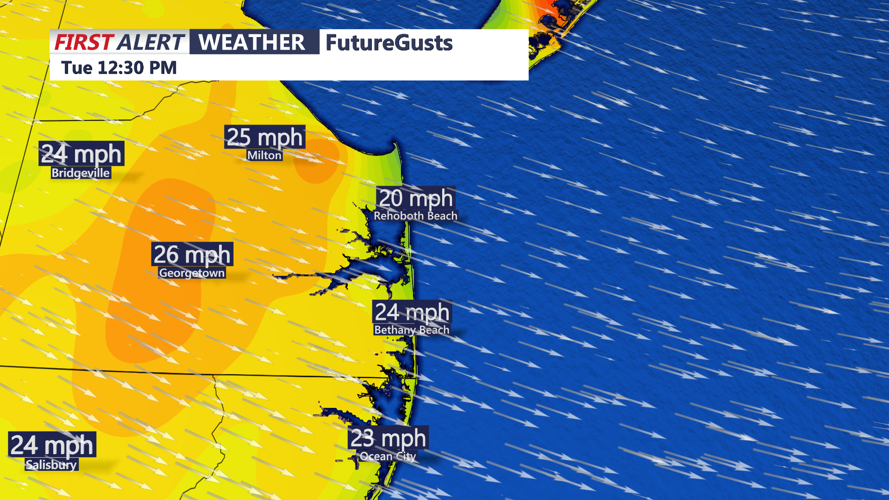
Winds will be a major story through the day, with gusts potentially reaching up to 40 mph by the afternoon. Temperatures will struggle to climb, with highs only in the upper 50s to mid-60s, making it feel even cooler with the wind chill.
Tuesday night, a secondary cold front sweeps through the region—this one largely dry, but delivering an extra shot of cold air. Winds will remain elevated but begin to taper slightly overnight. Lows will dip into the upper 30s and low 40s, setting the stage for the coldest night of the week.
Wednesday continues the cool, breezy pattern. Gusts will persist in the 25 to 35 mph range as the upper low remains nearby. Daytime highs will hover in the 40s and 50s under a mix of sun and clouds. While Wednesday should be drier overall, the instability aloft may still allow for a few isolated sprinkles in higher terrain or along the coast.
By Wednesday night, winds will ease as high pressure builds in from the west. Skies will clear out, allowing overnight lows to plummet once again—dropping into the mid-30s, with isolated pockets north of I-78 nearing the freezing mark. While conditions look too dry for widespread frost development, a few frost or freeze alerts could be needed if temperatures fall more than expected.
