


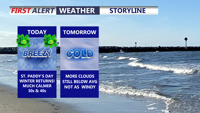

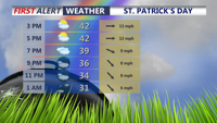


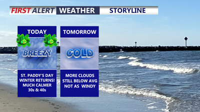
DELMARVA -- Winter is making a return as temperatures run 20 to nearly 30 degrees colder than yesterday. For St. Patrick’s Day, afternoon highs will only reach the upper 30s to low 40s, while west-northwest winds gusting between 25 and 30 mph make it feel even colder. Clouds will increase into the evening, and while most areas stay dry, a passing flurry cannot be ruled out.

Mostly sunny skies will give way to some clouds through this evening, even a brief snow shower/flurry possible.
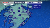
Tonight, skies gradually clear and winds begin to relax. That will allow temperatures to fall into the low to mid 20s by Wednesday morning.

Clearing skies overnight as temperatures fall into the low to mid 20s.
The cold pattern holds through Wednesday with a bit more cloud cover around the region. Highs will struggle to get out of the low 40s, and an east-northeast breeze will add to the raw feel.

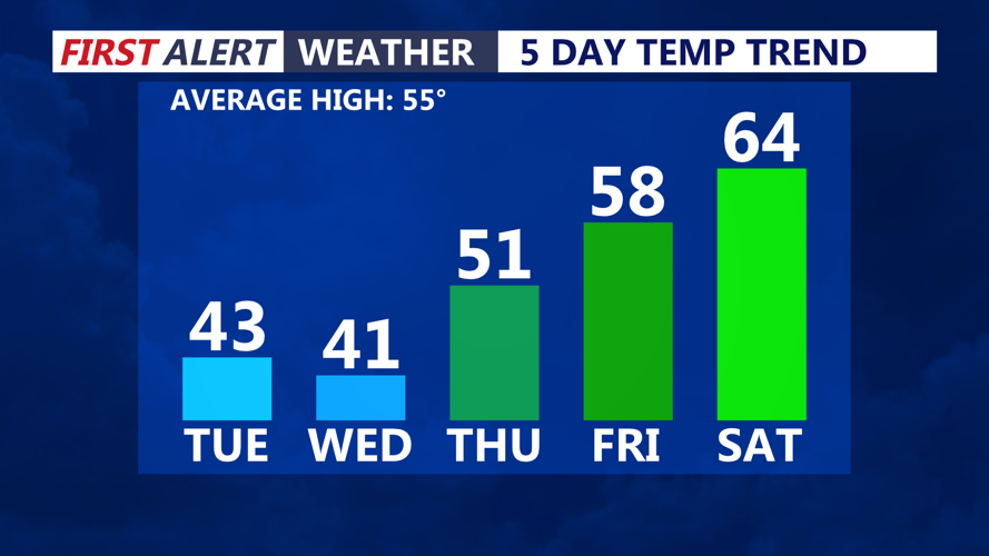
Temperatures moderating back into the 50s and 60s late week into the weekend.
Temperatures start to moderate on Thursday, though readings will still remain below average. Expect mostly sunny skies with highs in the low 50s.
Warmer air arrives Friday as spring officially begins at 10:46 a.m. with the vernal equinox, the point when day and night are nearly equal in length. Partly cloudy skies are expected with afternoon highs climbing into the upper 50s to low 60s.
A weak front moves through late Friday night into Saturday and could bring a chance of showers. Even so, the weekend looks milder overall, with highs in the mid 60s Saturday and models hinting at even further warming into the low 70s by Sunday ahead of another strong cold front.
That front is expected to bring another push of colder air to Delmarva early next week.