


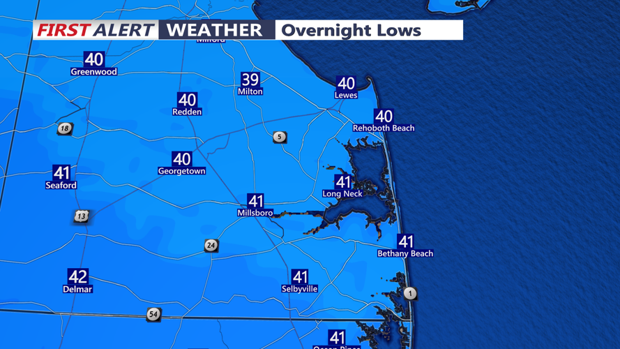
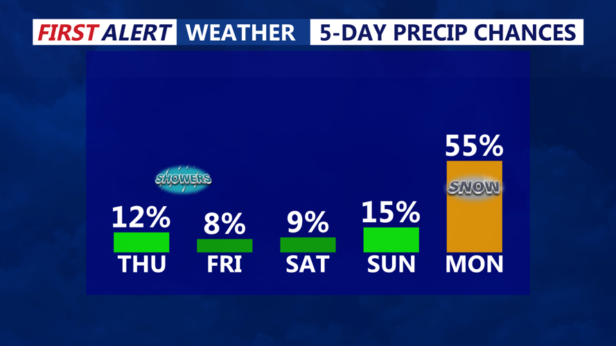


DELMARVA - Sussex County residents can expect a quiet late Wednesday evening before clouds thicken and a developing storm system brings a growing chance of precipitation on Thursday, with the odds increasingly favoring plain rain over snow.
A wave of low pressure is projected to track west to east south of the region Thursday into Thursday night. While marginally cold air will linger in the wake of Wednesday’s earlier system, recent trends have pushed the storm’s track farther south, reducing the likelihood that colder air and precipitation overlap enough to produce meaningful wintry weather.
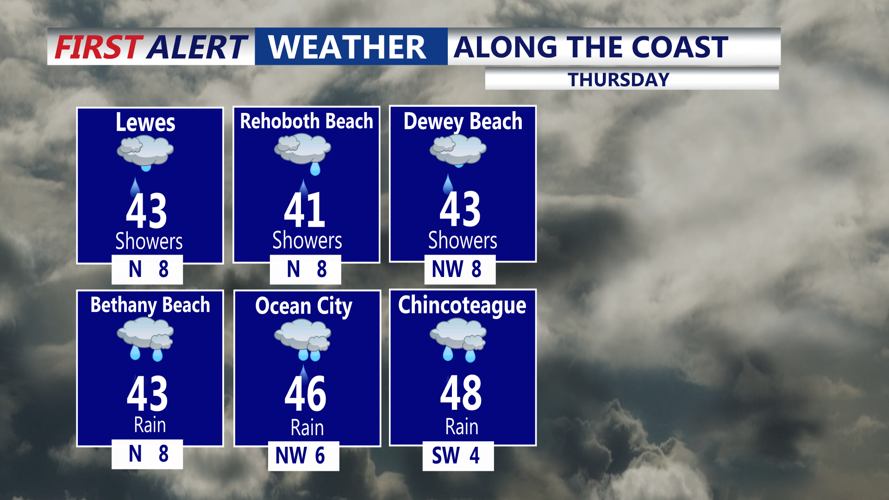
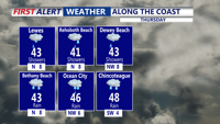
For Sussex County — including coastal communities from Lewes and Rehoboth Beach to Bethany Beach, as well as inland areas such as Georgetown and Seaford — temperatures are expected to be warm enough that precipitation falls mainly as rain from Thursday morning through late Thursday evening. A brief mix with wet snow cannot be ruled out at times, especially closer to northern portions of the broader region, but forecasters currently view accumulating snow as unlikely.
Mariners should remain alert to hazardous conditions on the water. A Small Craft Advisory was extended until 1 a.m. for coastal waters north of Cape May, and boaters traveling in nearby waters should monitor for changing conditions and additional marine headlines.
Looking ahead beyond Thursday evening, another low pressure system could approach early next week, bringing another chance for wintry weather as colder air returns. Confidence remains limited at this range, but the pattern bears watching for possible impacts Monday into Tuesday.