


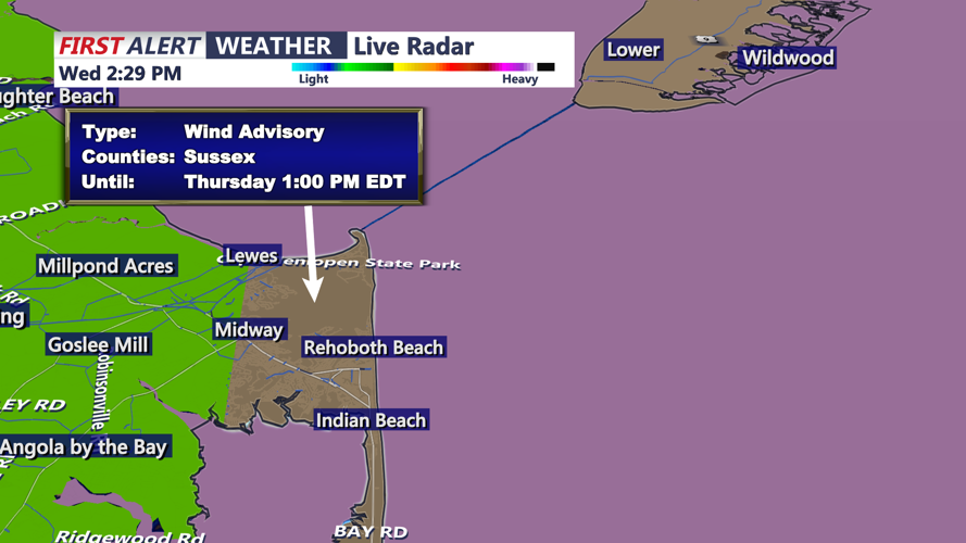


DELMARVA - Sussex County residents can expect unsettled weather from early Thursday into early Friday as a strong low-pressure system moves through the Mid-Atlantic and into New England.
Periods of steady rain early Thursday will gradually taper to showers by the afternoon as the storm system lifts northeast. Skies will begin to clear late Thursday night, but winds will remain strong through early Friday morning. Rainfall totals are expected to range from 1 to 3 inches, with heavier pockets possible before midday Thursday.
As the system departs, a tight pressure gradient will generate west to northwest winds sustained at 20 to 25 mph, with gusts between 35 and 45 mph. Along the Delaware beaches, gusts could briefly reach 50 mph, prompting the potential for additional wind advisories. Winds will gradually ease after sunrise Friday.
Temperatures will fall behind the front, with highs on Thursday in the upper 50s to near 60 °F and lows Thursday night dipping into the mid-40s. By early Friday, skies will clear and conditions will turn cooler and drier as high pressure builds in from the west, setting up a crisp, sunny start to the weekend.
