



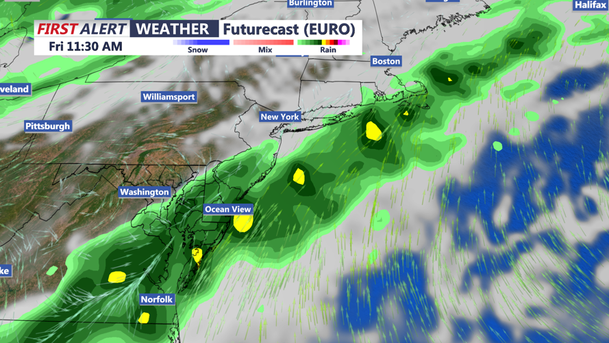
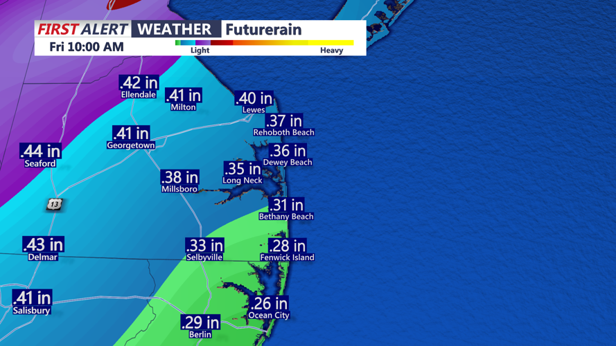
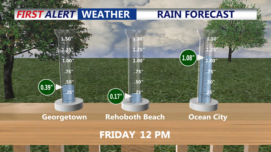

DELMARVA - A slow-moving cold front approaching Delmarva will bring increasing clouds, breezy conditions and a growing chance of rain Thursday, with the potential for locally heavy rainfall Thursday night into Friday across Sussex County and surrounding coastal communities.
Late Wednesday evening will remain generally quiet, with partly cloudy skies and light winds. Clouds will gradually increase overnight as moisture begins moving into the region ahead of the approaching cold front. Most communities, including Georgetown, Seaford, Millsboro, Lewes and Rehoboth Beach, should remain dry through the night.
Thursday will begin with considerable cloudiness and occasional breaks of sunshine. Rain chances will gradually increase throughout the day, particularly across western Sussex County, including Seaford, Laurel and Bridgeville. Communities farther east, including Lewes, Rehoboth Beach, Dewey Beach, Bethany Beach and Fenwick Island, could remain largely dry through much of the afternoon.
Southerly winds will increase Thursday morning and afternoon, with occasional gusts reaching 20 to 25 mph, especially near the Atlantic beaches. Temperatures will remain relatively mild ahead of the front, although increasing clouds may limit daytime warming.
By late Thursday afternoon and evening, scattered showers could become more widespread as the front inches closer to Delaware. The greatest potential for significant rainfall will develop Thursday night into Friday as the front slows and additional moisture moves into the region.
Current forecast guidance suggests a corridor of 1 to 1.5 inches of rain could develop from southern Delaware toward the New Jersey coastline during a 24-hour period. However, the precise location of the heaviest rainfall remains uncertain and will depend on where the frontal boundary stalls.
For Sussex County, the rainfall could provide beneficial moisture, although periods of heavier rain may produce ponding on roads and in low-lying areas, especially where rainfall becomes concentrated over a short period.
The unsettled pattern is expected to continue into Friday before the cold front finally pushes offshore Saturday. Drier air will follow, bringing improving conditions and cooler temperatures for the weekend.
Saturday afternoon highs are expected to reach the upper 50s to middle 60s, with overnight temperatures falling into the 40s. Additional cooling is anticipated Sunday into early next week, with afternoon temperatures generally in the upper 50s to lower 60s and nighttime lows potentially dropping into the 30s across inland Sussex County.
Along the Delaware beaches and nearby Atlantic waters, marine conditions will also begin deteriorating Thursday. Southerly winds will remain generally below 25 mph during the day, with seas building to 2 to 4 feet. By Thursday night, offshore waves could increase to 3 to 5 feet, with winds approaching Small Craft Advisory levels.
Boaters should monitor changing marine conditions, particularly Thursday night into Friday. Winds are expected to shift from the south to the west and northwest Saturday as the cold front moves offshore.
For residents and visitors from Prime Hook and Lewes south through Rehoboth Beach, Bethany Beach and Fenwick Island, the main weather concern will be the increasing potential for rain late Thursday and Friday rather than widespread hazardous conditions during the daytime Thursday.
The timing and placement of the heaviest rainfall will become clearer as the cold front approaches. Until then, Sussex County can expect a relatively quiet Wednesday night followed by a cloudier, breezier Thursday as the region prepares for a wetter end to the workweek.
