


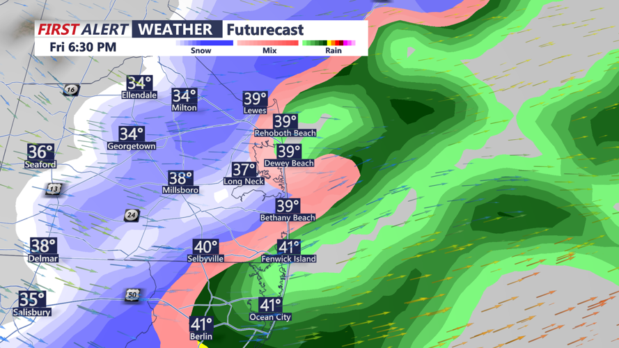


DELMARVA - A weak system moving through Delmarva this evening will bring light snowfall to parts of the region, with accumulations ranging from a slushy coating to an inch. A Winter Weather Advisory is in effect from 3 p.m. to 10 p.m. Friday for portions of the Eastern Shore and northern Delaware.

Slick slushy coating to an inch.
Snowfall is expected to start as rain south of Wilmington before transitioning to snow during the evening commute as temperatures cool. While this system is fast-moving, a brief band of heavier snow could develop, producing localized totals exceeding an inch. Temperatures are forecast to reach the upper 30s and low 40s before precipitation arrives, falling into the low to mid-20s overnight. So watch for slick and slushy conditions on the roadways this evening.
Dry, cold air will dominate Saturday as high pressure builds briefly over the region. Highs will struggle to rise above freezing, with wind chills making it feel like the teens during the day and single digits overnight. Winds could gust up to 30 mph, adding to the frigid conditions.
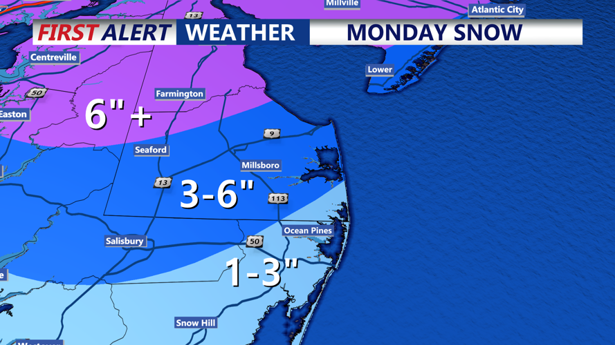
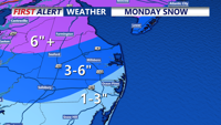
Looking ahead, a significant winter storm is poised to impact Delmarva late Sunday into Monday. Current models show the potential for widespread snowfall accumulations, though the exact storm track remains uncertain. Accumulations of 3-6 inches are possible, with higher amounts under mesoscale snow bands.

Impactful Snow Monday Morning On Delmarva
Areas along the coast may experience mixed precipitation, including sleet or freezing rain, due to warmer air aloft. As the system departs Monday evening, a bitterly cold airmass will settle over the region, keeping highs below freezing and lows in the teens for much of the week. Will continue fine tuning the snowfall map throughout the day and evening.

Snowfall Totals Monday-Monday Evening
