


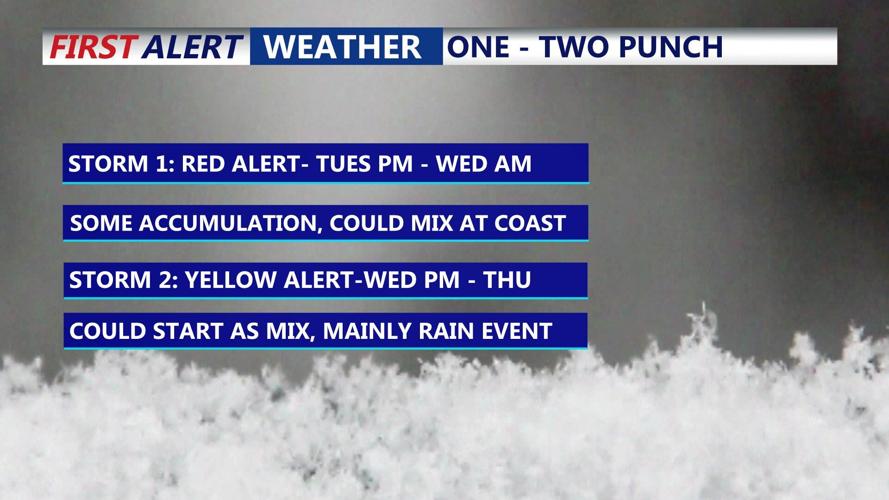


DELMARVA -- The National Weather Service has issued a Winter Storm Watch for the entire viewing area for Tuesday afternoon into Wednesday morning. The threat for significant snowfall and treacherous travel grows. We have a RED ALERT in place for Tuesday.
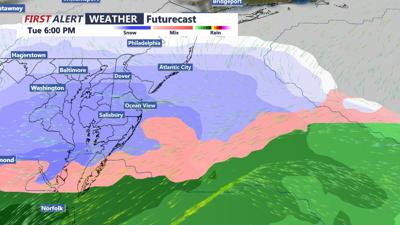
An area of low pressure will track to our south Tuesday spreading an area of snow into the area Tuesday afternoon and the snow will pick up in intensity through the evening into early Wednesday morning. The worst travel conditions would be Tuesday evening into the overnight. Parts of the peninsula could see up to 6 to 8 inches, similar set up from early January as the heart of Delmarva could be in line for the “bullseye“ for the heaviest snowfall totals.

An active week looms on the Delmarva peninsul.
This will be a one - two punch of storms this week because right on this systems heals in another storm that will track over the area or just to our west bringing in warmer air which means the second system will be primarily a rain maker.
Needless to say we have a high impact weather maker Tuesday afternoon-Wednesday morning. Stay with the COAST TV First Alert Weather team on-air, online and social media as we continue to update forecast totals and timing.
