


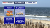
Temperatures near 100 degrees and heat index values as high as 109 will make Wednesday dangerously hot before Canadian wildfire smoke spreads across Delmarva.
From
To

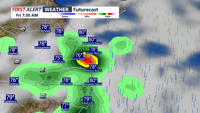
Showers and thunderstorms are expected to develop across Delmarva today, with damaging wind gusts and localized flash flooding the main concerns.

Sussex County can expect a calm, comfortable start to the weekend before unsettled weather returns Monday.

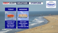
Delmarva stays sunny, dry and hot today as high pressure keeps control of the forecast. Inland highs climb into the low to mid 90s, while the beaches stay cooler in the mid 80s. Heat and humidity build Saturday before a cold front brings isolated storm chances Sunday, especially across southern Delmarva.

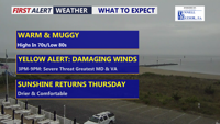
Delmarva has one more unsettled day ahead as a cold front approaches from the northwest. A Yellow Alert is in place for the threat of strong to severe thunderstorms this afternoon into early evening, with damaging wind gusts the main concern. Drier, more comfortable weather returns Thursday through the weekend.

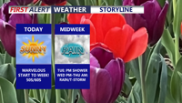
Delmarva will enjoy a bright and much-improved start to the week today as Canadian high pressure brings wall-to-wall sunshine, though temperatures will remain below average. A weak front may bring light rain late Tuesday, but the better chance for widespread showers and a few storms arrives late Wednesday into early Thursday, with some storms possibly strong to severe.

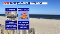
Delmarva faces an unsettled Sunday with showers and thunderstorms, some potentially severe with damaging winds and localized flash flooding. A warm front moves through ahead of a weak cold front Sunday night, followed by a hot and humid start to the week before a stronger midweek cold front brings relief heading into next weekend.

A warm front lifting into Delmarva Saturday night will bring clouds, muggy conditions, and a chance for storms, some of which could be strong with gusty winds. Sunday will feature periods of showers and thunderstorms before skies clear Monday, leading into a hot and humid start to the week. A midweek cold front promises relief by Friday and next weekend.

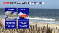
A weak cold front will bring relief from oppressive heat late Thursday, but unsettled conditions return for the weekend with a risk of showers and storms.

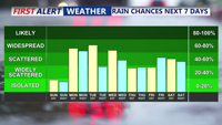
Sunday will deliver more summer warmth across Delmarva with highs in the 80s and only isolated thunderstorm chances. However, a cold front approaching Sunday night will trigger scattered showers and thunderstorms into early next week, followed by additional unsettled weather as stalled fronts linger and another system nears by the weekend.