


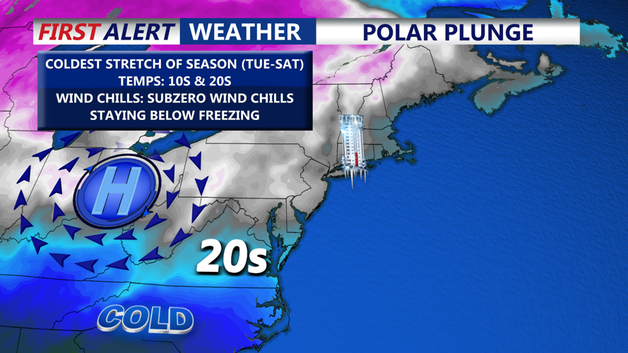


DELMARVA -- A prolonged stretch of bitter, dangerous cold is settling across the Delmarva Peninsula this week and could extend into the weekend, bringing temperatures well below freezing, single-digit overnight lows and wind chills dipping below zero.
Today will be the “warmest” day of the upcoming week, though temperatures are still expected to struggle to climb above the freezing mark. Highs will range from 26 to 33 degrees, with wind gusts up to 35 mph making it feel more like the teens.

Barely getting above 30 today, wind gusts to 30 mph making it feel like the teens.
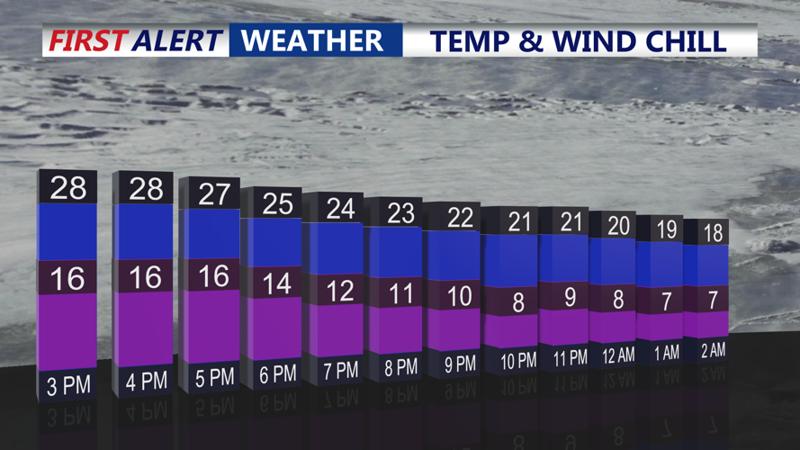
Conditions turn even colder tonight, with mostly clear skies and frigid lows between 8 and 14 degrees. Wind chills by Tuesday morning are expected to fall between three below zero and zero degrees.
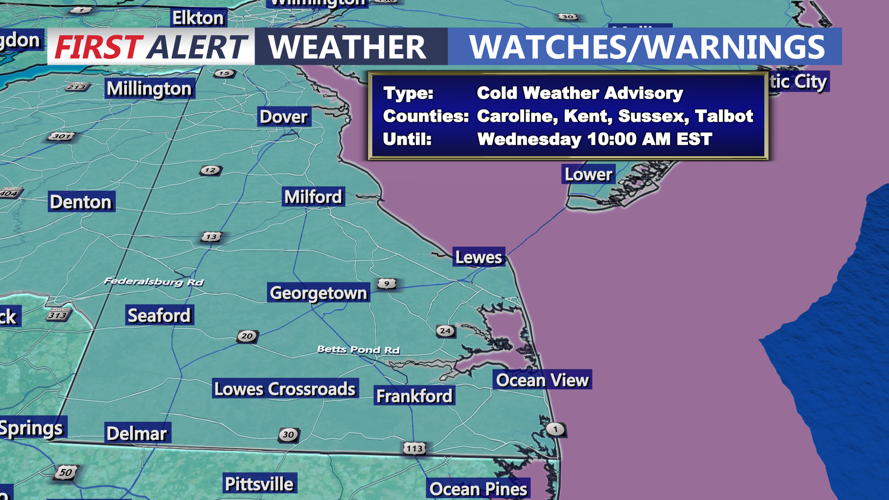
A Cold Weather Advisory is in effect for the entire Delmarva Peninsula tonight and Tuesday night, as wind chills dip below zero are expected across the area. Confidence remains high that wind chills will remain below zero for several nights, with even colder air reinforcing the pattern through the end of the work week.

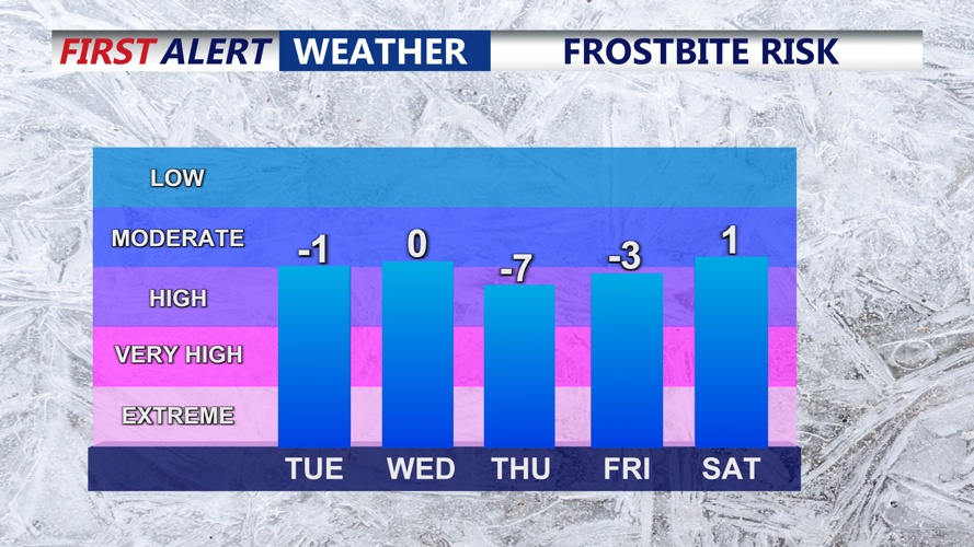
With subzero wind chills forecast over multiple days it's important to dress warm with plenty of layers.
The arctic blast will be sustained by a longwave trough setting up over the eastern United States, allowing multiple reinforcing shots of cold air to keep Delmarva locked in a deep freeze.
A cold front is expected to sweep through Tuesday night, though it is expected to be moisture-starved with no precipitation anticipated. The bigger impact will be another drop in temperatures.
While the Cold Weather Advisory is set to expire Wednesday morning, additional cold weather headlines may be needed Wednesday night through Friday night as temperatures continue to plummet.

Bitterly cold airmass moves into the eastern half of the country all week long.
Daytime highs for the middle and end of the week are expected to be in the mid to upper teens, with some locations barely reaching 20 degrees. Overnight lows Wednesday night and especially Thursday night could fall into the low single digits.
Thursday night currently appears to be the coldest stretch, with wind chills projected between minus 5 and minus 15 degrees. The cold could strain energy infrastructure and create dangerous conditions outdoors, with frostbite and hypothermia possible within minutes for anyone not properly layered.
It is exceedingly rare for Delmarva to experience an arctic air mass of this intensity and duration, and residents are urged to take the cold seriously, especially those who must spend extended time outside.
Looking ahead, we are also monitoring the potential for a coastal storm system developing off the Mid-Atlantic coast next weekend. Confidence remains low on whether a storm will develop, but there is agreement that cold air will be in place and temperatures will remain below normal, meaning any system that forms could bring snow depending on its track.
Stay up to date on the approaching winter storm with radar and hourly forecasts in the CoastTV weather app, available for Apple and Android.

