


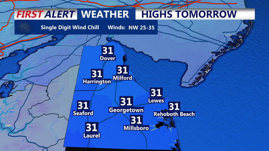
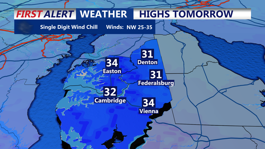

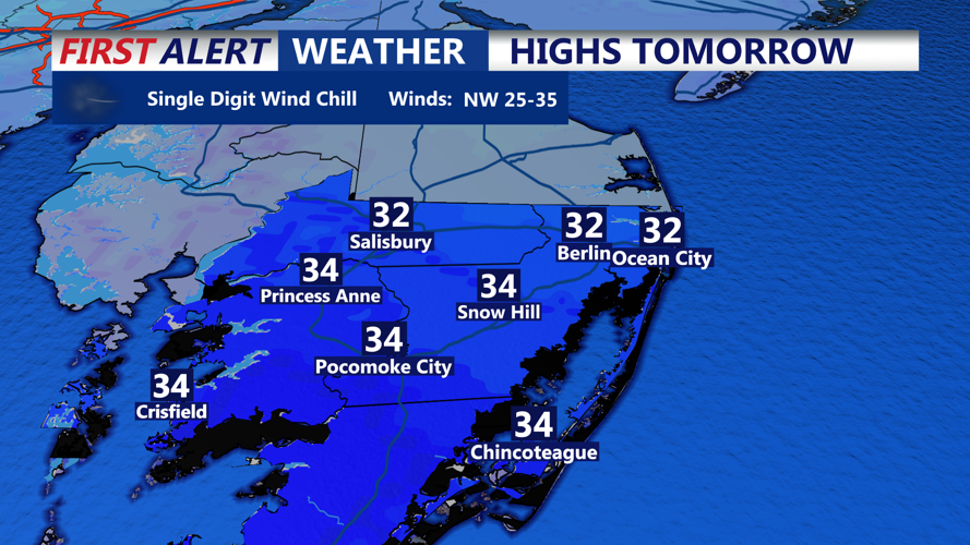


DELMARVA - Cold and blustery conditions will continue across Sussex County late Sunday evening as high pressure builds in behind the departing winter system. Temperatures will fall into the teens overnight, while northwest winds gusting up to 25 to 35 mph will keep wind chill values in the single digits for much of the night.
Skies are expected to gradually clear Sunday night, but the combination of cold air and persistent wind will make it feel significantly colder than actual temperatures. The coldest wind chills are expected overnight into early Monday morning.
By Monday, conditions remain dry, though clouds may increase through the afternoon as a weak disturbance passes nearby. Winds will slowly diminish during the day, helping improve wind chills compared to Sunday night. Afternoon highs are expected to reach the low to mid-30s across Sussex County.
Monday evening remains cold, with temperatures slipping back into the teens by late evening. Winds will be lighter than the previous night, generally between 5 and 10 mph, allowing wind chills to settle into the low teens rather than the single digits.