


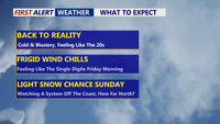


DELMARVA - Cold and breezy across Delmarva, with temperatures holding steady in the low to mid 30s under mostly sunny skies. West to northwest winds of 15 to 25 mph will persist through the day, with gusts frequently in the 30 to 40 mph range. The strongest winds may arrive this evening as colder air moves in and winds ramp up, making it feel sharply colder by nightfall.

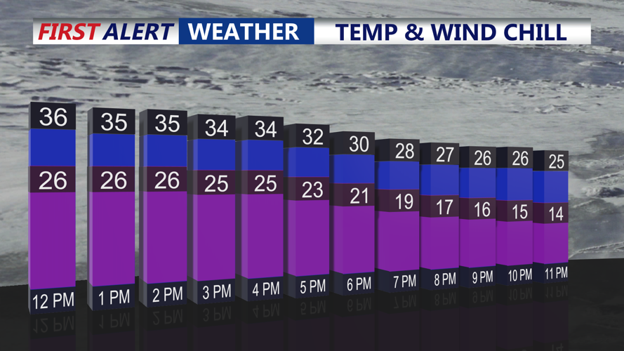
Temperatures in the mid 30s but wind chills in the mid 20s and teens.
Tonight, temperatures are expected to fall to about 18 to 25 degrees across Delmarva, and wind chills could dip into the single digits by Friday morning — especially in more open and coastal areas where winds stay up.

Wind Chills Friday morning: 8 to 15 degrees.
Friday looks quieter but still chilly, with mostly sunny skies and highs in the mid to upper 30s.
Attention then turns to the weekend, when multiple rounds of precipitation are possible as a larger cold-weather pattern settles over the Eastern U.S. The first system on Saturday appears weak, with precipitation most likely beginning near or just after daybreak. Early temperatures could support a brief period of snow at the onset, but as temperatures rise during the day, a transition to mainly rain is expected for most of Delmarva. Any precipitation Saturday currently looks light overall. Expect mostly sunny skies and highs in the mid 40s.

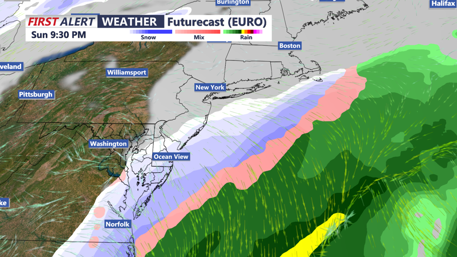
An area of low pressure offshore could track close enough to bring a light round of snow Sunday evening.
Behind the weekend systems, a prolonged stretch of below-normal temperatures is expected from Sunday into the middle of next week. High pressure should bring dry weather, but the cold will deepen, with daytime highs struggling to reach freezing and Tuesday potentially stuck in the 20s. Overnight lows and wind chills will be the main concern, with several nights featuring single-digit “feels-like” temperatures.