




DELMARVA - A sharp change in weather will continue across southern Delaware Saturday afternoon as strong northwest winds and much colder temperatures follow Friday night's powerful cold front, setting the stage for a chilly Saturday night and a mostly sunny but breezy Sunday.
Expect lingering showers to gradually end by early Saturday afternoon, allowing clouds to break for some sunshine. Despite improving skies, temperatures will struggle to rise beyond the lower and middle 50s, nearly 25 degrees colder than Friday.
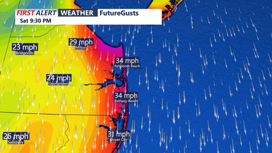
Northwest winds of 15 to 25 mph will remain a major concern Saturday afternoon, with gusts reaching 30 to 40 mph. These strong winds will create particularly blustery conditions across exposed coastal communities, including Lewes, Rehoboth Beach, Dewey Beach, Bethany Beach and Fenwick Island.
Residents should secure loose outdoor decorations, furniture and other lightweight objects. Drivers should also exercise caution on bridges and open roadways where sudden crosswinds may affect vehicle handling.
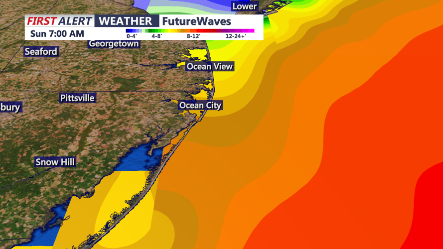
Dangerous marine conditions will continue through Saturday night. A Gale Warning remains in effect for Delaware's Atlantic coastal waters through 6 a.m. Sunday, with north winds gusting to around 45 mph and seas of 5 to 8 feet expected. Seas may build higher into Sunday as northeast winds continue.
For Delaware Bay, a Gale Warning remains in effect until 6 p.m. Saturday. Mariners should avoid unnecessary travel as strong winds and rough waters create hazardous boating conditions.
By Saturday evening, skies will become mostly clear as colder, drier air settles across Sussex County. Temperatures will drop quickly after sunset, with overnight lows generally reaching the middle 30s to lower 40s. Sheltered inland locations could experience colder readings, while communities near the immediate coastline should remain somewhat milder.
Although frost and freezing temperatures are expected farther north across portions of Pennsylvania and New Jersey, no Freeze Watch has been issued for Sussex County. Persistent winds may limit widespread frost formation, but residents with sensitive plants should continue monitoring overnight temperatures.
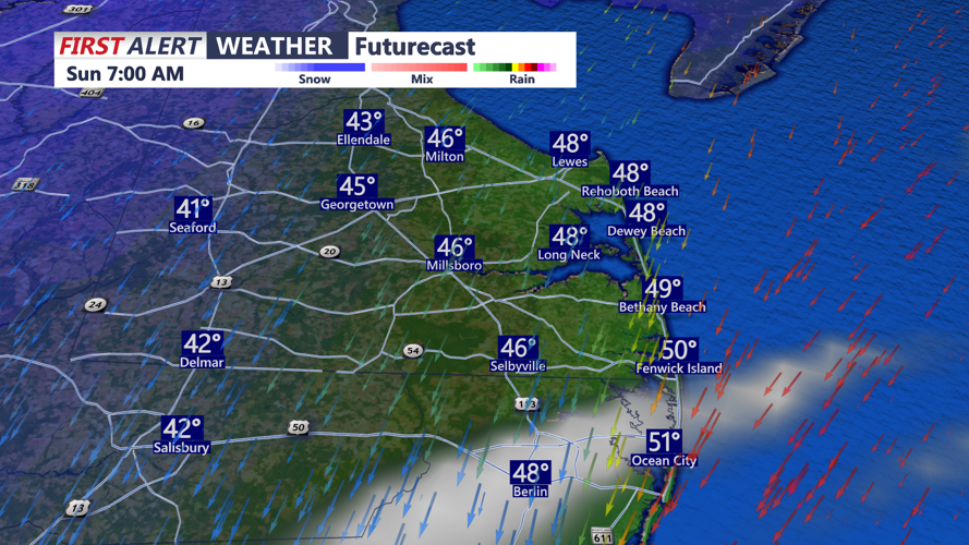
Sunday morning will begin chilly but mostly sunny, with temperatures gradually climbing through the 40s. Northeast winds will remain noticeable, particularly along the beaches, as high pressure builds across the region.
By Sunday afternoon, temperatures should recover into the middle and upper 50s under mostly sunny skies. However, breezy conditions will make it feel cooler, especially near the Atlantic coastline.
Meanwhile, we continue monitoring a developing nor'easter expected to organize off the North Carolina coast later this weekend. While uncertainty remains regarding the storm's track and proximity to Delmarva, strengthening northeast winds and increasingly rough surf could affect Delaware's beaches into early next week.
The National Weather Service cautions that additional periods of gale-force winds are possible over the Atlantic waters Sunday night into next week, with offshore seas potentially reaching 10 to 16 feet or higher.
Although widespread rainfall is not currently expected Sunday, the developing coastal system could introduce additional chances for showers beginning Sunday night and continuing into the upcoming week.
For Sussex County residents, the weekend's main concerns remain strong winds Saturday, a chilly Saturday night and hazardous marine conditions that could persist well beyond Sunday.
