


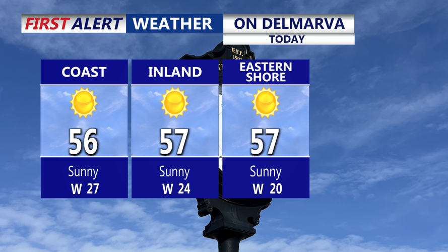


DELMARVA -- High pressure building across the Southeast is helping to keep Delmarva dry today, even as a strong low over southeastern Quebec keeps the pressure gradient tight. That means another windy day, with west-southwest gusts around 25 to 30 mph this afternoon. Despite the breeze, cold air is not as strong as yesterday, and afternoon temperatures will climb into the mid to upper 50s across the Peninsula under mostly clear skies.

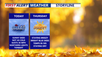
Wall-to-wall sunshine with highs in the mid to upper 50s, breezy south to west winds to 25-30 mph.
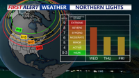
If you missed the Northern Lights Tuesday night, you may get another chance this evening. According to the Space Weather Prediction Center a severe geomagnetic storm (G4 to possibly G5) is expected as coronal mass ejections from the sun reach Earth today. With clear skies forecast over Delmarva, viewing conditions for the Aurora Borealis look favorable after dark.

According to the Space Weather Prediction Center, we could be in for another show of the Northern Lights this evening on Delmarva.
A weak cold front will slide through overnight, but it is not expected to produce much, if any, precipitation. Overnight lows will fall into the upper 30s to low 40s.

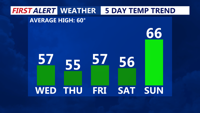
Temperatures in the mid to upper 50s, rising above average Sunday.
Thursday and Friday stay quiet but brisk. High pressure centered from the Tennessee and Ohio valleys into the Gulf Coast states will dominate while an upper trough lingers over the Northeast. On Delmarva, sunny skies are expected both days with highs generally in the low to mid-50s and lows Thursday night in the 30s. Northwest winds will remain gusty on Thursday, 15 to 20 mph with gusts to 25 to 30 mph, before easing on Friday as the pressure gradient relaxes.
High pressure sits over the region Saturday with seasonable highs in the low 50s and increasing clouds through the day ahead of the next system. A clipper low passing north of Delmarva Saturday night into Sunday will pull in milder air, so any precipitation is expected to fall as plain rain. Lows Saturday night will hold in the mid-40s, and Sunday will be unseasonably mild, with highs in the mid to upper 60s to near 70 before a cold front pushes through Sunday night.
Behind that front, temperatures tumble back to near or just below normal on Monday, with highs only in the upper 40s to low 50s and another round of strong west to northwest winds, 15 to 20 mph with gusts of 25 to 30 mph. High pressure builds back in from the upper Midwest and Great Lakes, bringing dry but cooler conditions. A weak low may approach on Tuesday, bringing the chance for more clouds and a few showers to parts of Delmarva.
