


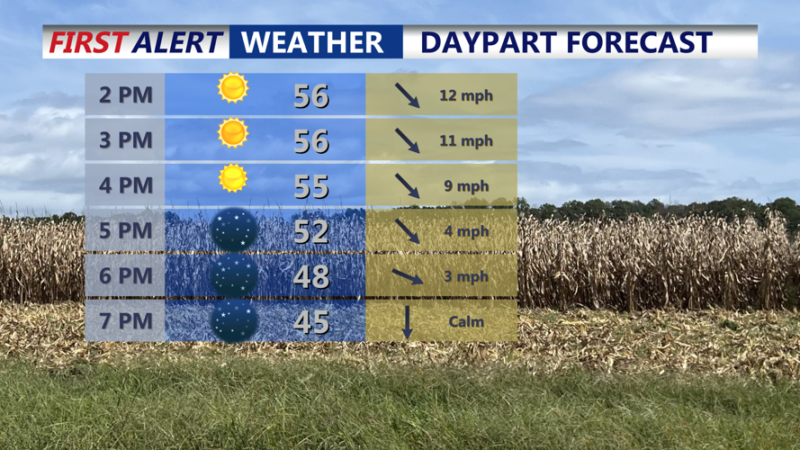


DELMARVA -- A beautiful brisk Thursday with highs in the upper 50s under mostly sunny skies. Winds will be calming into the evening.

Mostly sunny skies, with cool highs in the upper 50s.
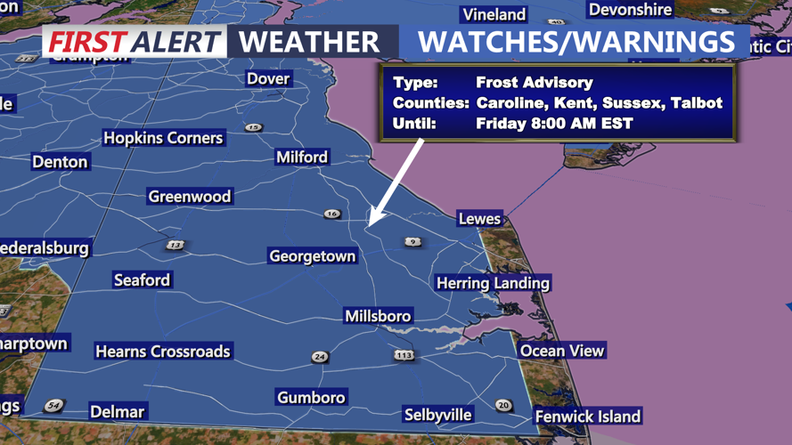
A frosty night lies ahead for much of Delmarva as high pressure builds into the region, setting the stage for a calm but chilly Thursday night and Friday. Clear skies and light winds will allow for strong radiational cooling overnight, with temperatures dropping into the low to mid-30s. A Frost Advisory is in effect for Sussex and Kent counties in Delaware, as well as the northern Mid-Shore, from 1 a.m. to 8 a.m. Friday.

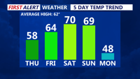
Roller coaster temperatures over the next 5 days, a little something for everyone.
High pressure will keep skies mostly sunny and conditions tranquil through Friday afternoon, clouds increase late with highs reaching the upper 50s. As that system slides offshore Friday evening, milder air from the southwest will flow into the region. Clouds will increase ahead of an approaching front, bringing a few light showers Friday night. Rainfall amounts will be light—less than a tenth of an inch—with lows staying mild in the low 50s.
Saturday will feature the warmest weather of the stretch, as a Pacific air mass pushes in behind the front. Highs are expected to reach the upper 60s, possibly touching 70 degrees across parts of Delmarva.
By Sunday, another system will bring a higher chance for rain as low pressure develops over the region and tracks northeast. Temperatures will remain mild ahead of the cold front, again reaching the 60s to near 70.
A sharp cooldown follows late Sunday into Monday as Canadian high pressure dives south, delivering the coldest air of the season so far. Highs Monday and Tuesday will only reach the 40s, with widespread freezing temperatures expected Monday night. A few flurries or sprinkles may develop early in the week, though no significant precipitation is expected.

Blast of cold air arrives early next week, below average highs and widespread freeze likely.
By Wednesday, temperatures should rebound slightly, with highs returning to the 50s as the cold air mass begins to lift out.