


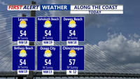


DELMARVA -- High pressure will dominate conditions across Delmarva today, keeping skies mostly sunny with afternoon highs climbing into the mid-fifties.

Mostly sunny skies, highs in the mid 50s, winds gusts to 25 mph.
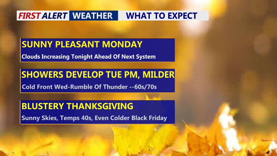
Clouds will begin to increase late in the day as the next system approaches from the west. Tonight, the high shifts offshore, allowing cloud cover to thicken. Winds will become calm overnight, and the additional cloud cover will keep temperatures from dropping too sharply. Lows will settle into the mid-thirties to low forties.

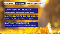
Showers develop Tuesday afternoon-evening, scattered showers Wednesday even a rumble of thunder possible.
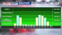
On Tuesday, the pattern begins to turn unsettled as high pressure departs and low pressure approaches from the west. An overcast sky is expected, and rain chances will rise from west to east through the afternoon. Temperatures will moderate slightly, reaching the low sixties. Widespread rain is likely Tuesday night as a warm front lifts through the region, keeping overnight lows mild in the mid-fifties.
Showers will linger Wednesday as a cold front moves closer, with scattered activity continuing through the day. Forecast models also suggest some elevated instability by Wednesday afternoon and evening, meaning a few rumbles of thunder cannot be ruled out. Ahead of the front, temperatures will be unseasonably warm, ranging from the sixties to near seventy. The front is expected to clear the region Wednesday evening, ending rain chances. Rainfall totals across Delmarva should generally fall between one-quarter and one-half inch, with isolated higher amounts possible.
Behind the front, much colder air will rush in Wednesday night. Lows will drop into the low to mid-thirties, and gusty northwest winds—possibly exceeding thirty miles per hour—will push wind chills into the twenties.

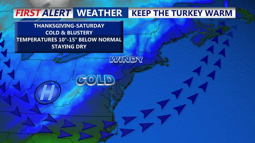
Big trough in the east will bring a winter-like feel back to the area late week.
Thanksgiving and Black Friday will feel brisk, with strong northwesterly winds and continued cold air advection. Highs will remain in the forties both days, and overnight lows will fall into the twenties. Despite the chill and breezy conditions, the holiday period currently looks dry.
Winds are expected to ease Friday night into the weekend as high pressure rebuilds, though temperatures will stay several degrees below average. By Sunday, some moderation may occur, but forecast models diverge on how quickly the next storm system arrives. Precipitation chances look to increase sometime late in the weekend.
