




DELMARVA -- Today brings a much calmer start across Delmarva following Thursday night’s powerful storms. A cold front has moved through the region, allowing temperatures and humidity levels to fall and providing a brief break from the unsettled weather.
A tornado was confirmed in Dover, Delaware, following Thursday night’s storms. Additional information is expected today as the National Weather Service will announce survey plans and damage assessments.
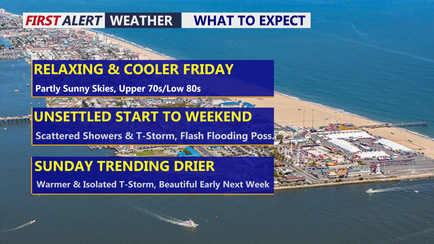
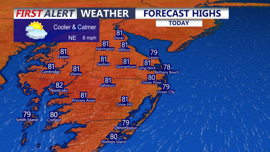
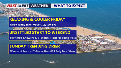
Temperatures are starting Friday in the 60s across Delmarva, with dew points also in the 60s. Morning clouds will gradually give way to mostly sunny or partly cloudy skies. Afternoon temperatures will reach the upper 70s to low 80s, with northeast winds around 5 to 10 mph.

Partly sunny skies and highs in the upper 70s to low 80s, northeast winds 5 to 10 mph.
The pleasant conditions will not last long. The cold front responsible for the change in weather will stall south of Delmarva as an area of low pressure begins moving northeast along the boundary.
Clouds will increase tonight, with showers developing overnight as temperatures fall into the upper 60s.

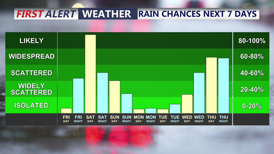
Showers develop overnight into Saturday, rain could be heavy at times during the day on Saturday.
Attention then turns to Saturday afternoon and Saturday night, when another period of heavy rain is expected across Delmarva. Atmospheric moisture will increase significantly, with precipitable water values approaching 2 inches. Thunderstorms that develop could become very efficient rainfall producers.
The exact location of the heaviest rain remains uncertain, but some forecast guidance indicates that localized rainfall totals could exceed 4 inches. Many locations across Delmarva received more than an inch of rain Thursday, leaving the ground saturated and increasing the potential for rapid runoff and flash flooding.
Much of Delmarva is under a Slight Risk for excessive rainfall Saturday. Residents should remain alert for areas of flooding, particularly in low-lying locations, poor-drainage areas and places that experienced flooding during Thursday’s storms.
The severe thunderstorm threat Saturday appears lower than what Delmarva experienced Thursday. Wind shear, instability and overall forcing are expected to be weaker. An isolated strong or severe thunderstorm remains possible, but the risk of damaging winds, hail or tornadoes is considerably lower.
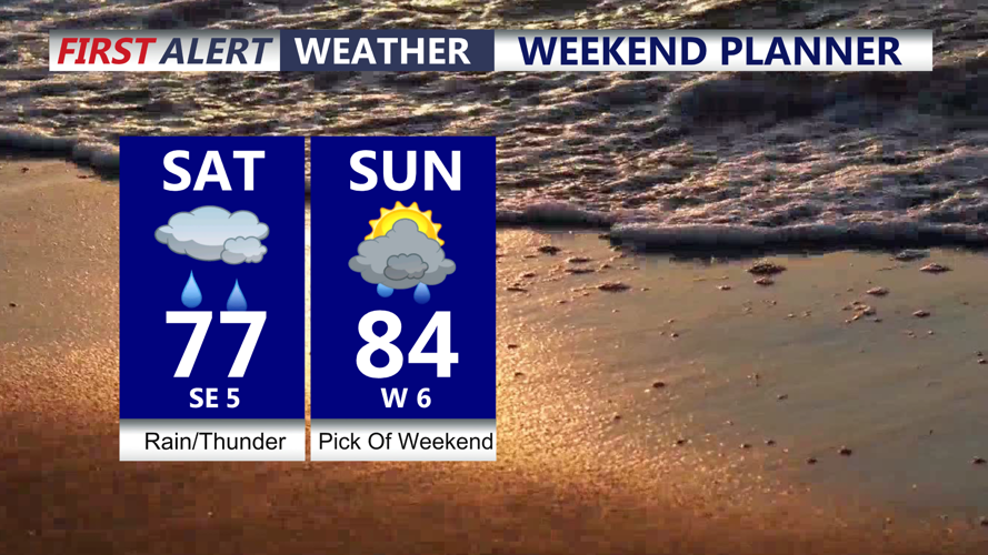
Raw temperatures with many areas stuck in the 70s for highs Saturday and some low 80s across the Lower Shore.

Scattered showers and t-storm Saturday, warmer with an isolated shower chance Sunday.
Isolated Showers could linger into Sunday as the area of low pressure moves away, although widespread significant weather is not expected through the day. Sunday looks like the drier of the two days this weekend and warmer as temperatures rise back into the mid 80s.
Drier and more tranquil conditions are expected to return early next week. High pressure should bring seasonable temperatures and mainly dry weather Monday through Wednesday before another frontal system approaches toward the end of the week.
