


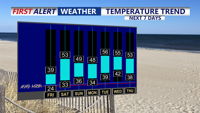
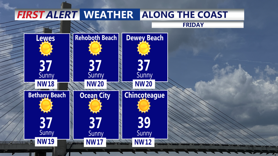

DELMARVA - We will wake up to a sharp chill early Friday as colder air settles in behind a departing coastal low, with temperatures in the teens to lower 20s to start the day.
Clouds that lingered Thursday evening are expected to thin out, setting up a mainly sunny Friday. Afternoon temperatures should recover only modestly, topping out in the 30s — still below normal for mid-February — with any lingering breeze gradually relaxing as high pressure builds closer.
Friday night turns colder again as skies stay mostly clear and the air remains dry. Temperatures are expected to slide back into the teens and lower 20s by early Saturday morning, making for a frosty start to the weekend.
A fast-moving disturbance may spark a few light snow showers late Friday night into early Saturday, but the best chance for those is expected well north of Sussex County, generally along and north of the Interstate 78 corridor. Even where snow does fall, amounts would be light and short-lived — though any brief coating could create isolated slick spots on untreated roads in colder locations.
