




DELMARVA - Dry and tranquil weather will continue across Sussex County late Monday night through late Tuesday night as high pressure gradually builds toward the Mid-Atlantic, bringing chilly overnight temperatures, abundant sunshine and light winds.
Late Monday night will feature mainly clear skies as northwest winds diminish and become nearly calm in some locations. The combination of clear skies and light winds will allow temperatures to fall steadily, creating favorable conditions for overnight cooling.
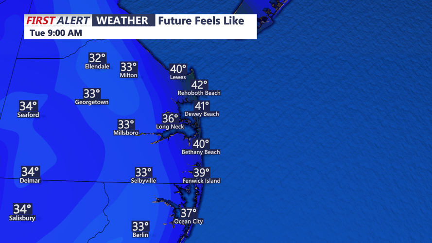
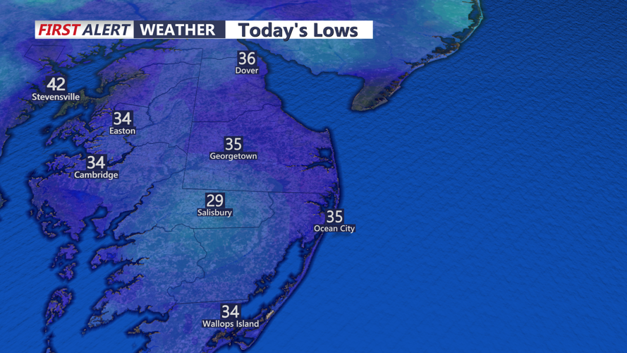
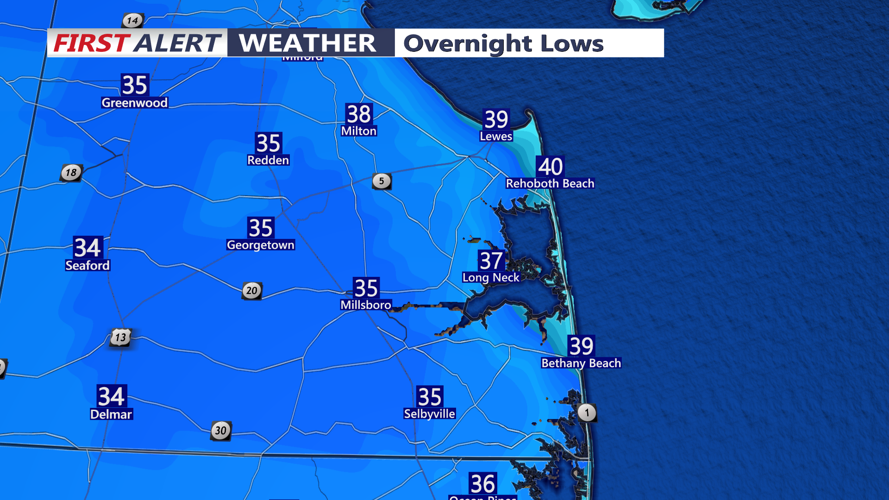
Temperatures are expected to drop into the lower 30s across much of inland Sussex County, including Georgetown, Seaford, Laurel and Millsboro. Some sheltered rural communities could briefly fall into the upper 20s, allowing patchy frost and freezing conditions to develop.
Coastal locations from Lewes and Rehoboth Beach south through Dewey Beach, Bethany Beach and Fenwick Island should remain slightly warmer, with overnight lows generally in the middle to upper 30s due to the moderating influence of the Atlantic Ocean.
Tuesday morning will begin with clear skies and chilly temperatures, especially across inland communities where readings could be near or below freezing around sunrise.
Sunshine will dominate throughout Tuesday as high pressure continues moving eastward from the Midwest toward the Ohio Valley and central Appalachians.
Afternoon temperatures will gradually recover into the lower to middle 50s across Sussex County, remaining slightly below normal for mid-November.
West to northwest winds will remain relatively light, generally below 10 mph, making conditions feel more comfortable than the blustery weather experienced over the weekend.
Along Delaware's Route 1 corridor, including Lewes, Rehoboth Beach, Dewey Beach, Bethany Beach and Fenwick Island, sunshine and lighter winds will provide favorable conditions for outdoor activities, although jackets may still be needed during the morning and late afternoon.
Tuesday evening will remain quiet and dry as high pressure continues strengthening across the region. Skies will stay mainly clear, allowing temperatures to fall quickly after sunset.
By late Tuesday night, temperatures are expected to settle into the lower to middle 30s across inland Sussex County, with upper 30s possible closer to the beaches.
Another round of patchy frost could develop in colder inland locations where winds become calm and temperatures approach freezing.
No rainfall is expected during the forecast period, and there are no significant weather hazards anticipated across Sussex County.
Marine conditions will also remain favorable along Delaware's Atlantic coastal waters and Delaware Bay.
Northwest winds will gradually shift toward the west Tuesday, generally remaining around 10 to 15 mph or less. Seas are expected to range from 1 to 2 feet, with winds and waves staying below Small Craft Advisory criteria.
Looking beyond Tuesday night, high pressure will settle over the Mid-Atlantic Wednesday and remain influential through the end of the week.
Temperatures will gradually moderate, with afternoon highs climbing through the 50s Wednesday and Thursday before reaching the lower 60s by Friday.
For Sussex County residents, Tuesday will offer a pleasant combination of sunshine, light winds and dry conditions, although chilly nights will remain a reminder that November's colder weather has arrived.
