



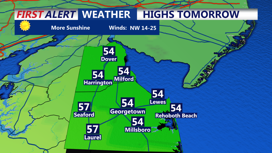

DELMARVA - A chilly but quiet weather pattern will continue across Sussex County late Sunday evening through late Monday evening as high pressure gradually approaches from the Midwest, bringing dry conditions, diminishing winds and the beginning of a warming trend heading into midweek.
Sunday evening will feature decreasing cloud cover across southern Delaware as northwest winds gradually weaken. Temperatures will fall steadily overnight under partly cloudy to mostly clear skies, with the colder air mass remaining firmly in place across Delmarva.
Overnight lows are expected to drop into the upper 20s to lower 30s across inland communities, including Georgetown, Seaford, Laurel and Millsboro. Coastal locations from Lewes and Rehoboth Beach south through Bethany Beach and Fenwick Island may remain slightly milder, with temperatures generally in the lower to middle 30s.
Northwest winds around 10 mph early Sunday evening will gradually diminish overnight, allowing temperatures to fall closer to freezing in many locations.
Monday morning will begin on a cold note, with temperatures near or below freezing across portions of Sussex County. Residents heading to work or school should prepare for a chilly start, particularly across inland areas where the coldest temperatures are expected.
Despite the cold morning, Monday will feature a mixture of sunshine and occasional clouds as high pressure continues advancing toward the Mid-Atlantic.
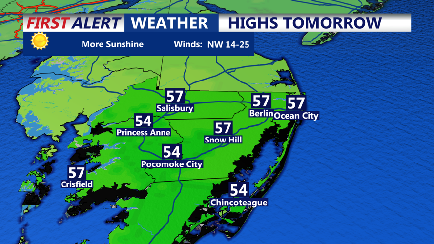
Afternoon temperatures are expected to climb into the upper 40s to lower 50s across much of Sussex County, remaining slightly below normal for mid-November.
Northwest winds around 10 to 15 mph will add a chill to the air, particularly along Delaware's Atlantic beaches and other exposed locations. However, winds will be considerably lighter than those experienced during the recent stormy weather.
Communities along the Route 1 corridor, including Lewes, Rehoboth Beach, Dewey Beach, Bethany Beach and Fenwick Island, can expect generally favorable weather for outdoor activities, although jackets will still be necessary.
By Monday evening, skies will remain mostly clear to partly cloudy as high pressure continues building toward the region. Temperatures will once again fall through the 40s and into the 30s overnight, with another chilly start expected Tuesday morning.
The colder-than-normal pattern will gradually ease Tuesday and Wednesday as high pressure moves directly overhead, allowing afternoon temperatures to moderate.
Daytime highs are expected to recover into the 50s by midweek, although overnight temperatures may remain slightly below normal for another day or two.
A more noticeable warming trend is expected Thursday and Friday as high pressure shifts offshore and winds gradually turn toward the south and southwest.
This change in wind direction will allow milder air to spread across Sussex County, bringing temperatures closer to or potentially above seasonal averages late in the week.
The extended forecast remains largely dry, with fair weather expected through Friday and no significant storm systems anticipated during that period.
Marine conditions will also remain relatively favorable as high pressure takes control.
Northwest winds will continue across Delaware Bay and the Atlantic coastal waters Sunday night into Monday, but wind speeds and wave heights are expected to remain below Small Craft Advisory criteria.
Generally tranquil marine conditions should continue through Thursday, providing an improvement for recreational boaters and commercial fishing operators following the recent period of strong winds and hazardous seas.
For Sussex County residents, the beginning of the week will serve as a reminder that winter is approaching, but the extended stretch of dry weather and gradually warming temperatures should provide more comfortable conditions heading toward the latter half of November.
