


DELMARVA - Skies are expected to remain mostly clear late Tuesday evening across Sussex County, setting the stage for another cold night. Light winds and lingering snowpack will allow for effective radiational cooling, with temperatures dropping into the upper teens to low 20s inland. Areas closer to the coast should stay milder, with lows near 30. Winds will begin to turn southwest and increase toward daybreak ahead of an approaching cold front, which may cause temperatures to bottom out earlier in the night rather than near sunrise.
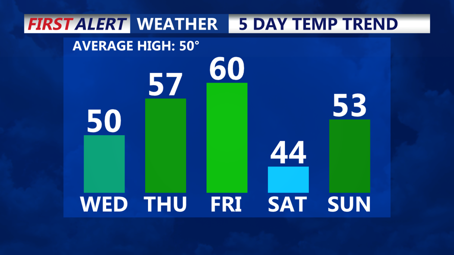
Wednesday will begin mostly sunny before mid- and high-level clouds increase during the late morning and afternoon. Southwest winds will strengthen through the day, with gusts between 20 and 30 mph. Temperatures will rebound significantly compared to recent days, climbing into the upper 40s across Sussex County.
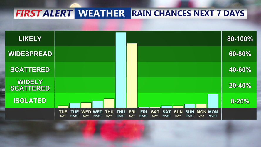
A cold front is expected to pass through the area Wednesday afternoon into early evening. Despite the frontal passage, precipitation is not expected. Skies may begin to clear again by Wednesday evening as high pressure builds in, setting up another cold night.