


Clouds and spotty showers began to ease sooner than expected Wednesday evening across Sussex County as a low-pressure system off the Virginia coast moves away.
Skies will continue to clear overnight as high pressure builds in from the north. Breezy northeast winds of 20 to 25 mph will gradually decrease overnight, with lows in the 50s to low 60s.
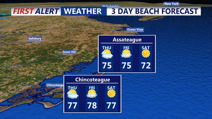
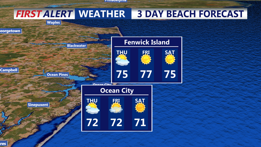
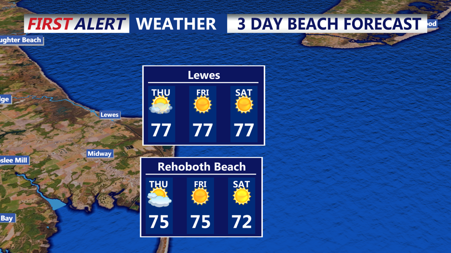
Thursday is expected to bring mainly sunny skies, comfortable humidity and seasonable temperatures, with highs in the upper 70s to near 80 and light northerly winds.
Clear conditions are forecast Thursday night with lows in the 50s. Friday will feature mostly to partly sunny skies and highs ranging from the mid-70s to low 80s. The high pressure system will continue to dominate through the start of the weekend, keeping conditions dry into Saturday.
Looking ahead, an upper-level trough moving into the Mid-Atlantic could increase the chance for showers and thunderstorms beginning Sunday and into early next week, although uncertainty remains about timing and coverage. Highs are expected to remain in the 70s with overnight lows in the 50s during the extended period.