


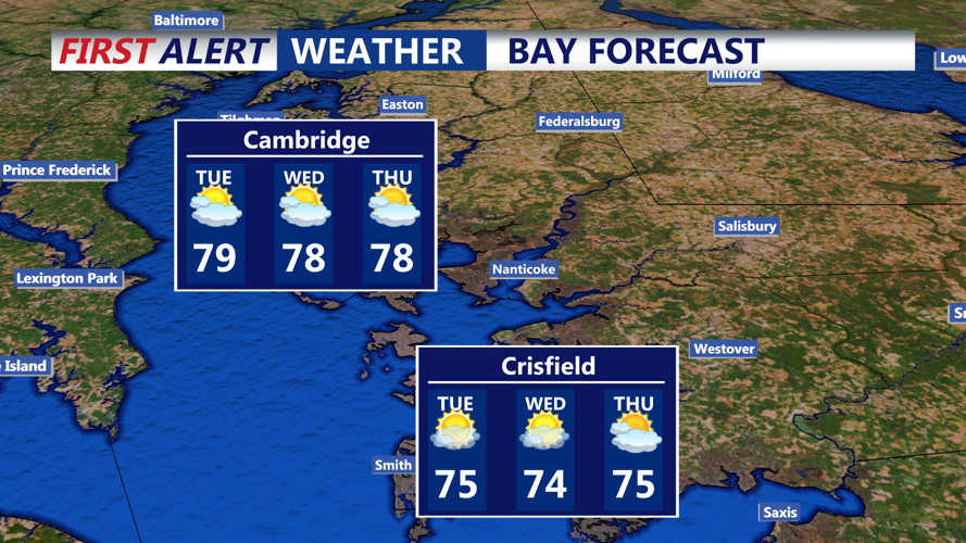


DELMARVA - Beachgoers in Delaware will want to keep umbrellas close and plans flexible through Wednesday morning, as a complex weather pattern keeps clouds, fog, and periods of rain in the forecast for the coast.
A stacked upper-level low pressure system is slowly tracking northeastward through the Mid-Atlantic and will remain a key influence through Tuesday night. This system, coupled with lingering surface lows, continues to pump moist onshore flow into Sussex County and surrounding areas, especially along the beach towns of Rehoboth Beach, Bethany Beach, and Fenwick Island.
Through Monday night, expect overcast skies, widespread showers, patchy dense fog—especially near the coast—and a chance for isolated thunderstorms, particularly after midnight. Coastal fog may reduce visibility at times to under a mile, creating hazardous travel conditions for late-night drivers and early risers.
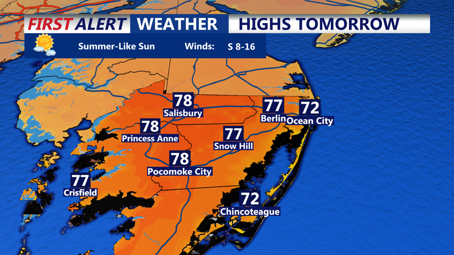
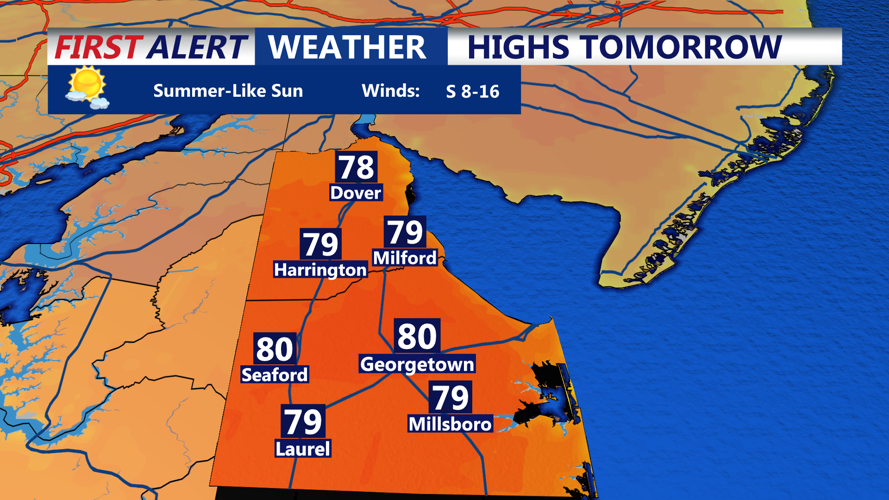
On Tuesday, winds gradually shift to the south as the low drifts northward, allowing for partial clearing during the day. Sunshine may break through in spots, particularly inland, raising afternoon temperatures into the upper 70s. With increased daytime heating, scattered thunderstorms may redevelop in the afternoon and early evening, especially farther northwest near the I-95 corridor. Some of these storms may be strong, with gusty winds and brief downpours.
By Tuesday night into early Wednesday, the upper-level system begins to exit the region. A few lingering showers are possible, but skies are expected to gradually clear by late Wednesday. Daytime highs on Wednesday should remain mild, hovering in the low to mid 70s along the beaches.
Looking beyond midweek, another upper-level trough is forecast to arrive Thursday, renewing chances for scattered showers by late Thursday into Friday. Drier and more seasonable weather appears to return by the weekend, just in time for outdoor plans along the Delaware coast.
